


The Problem We All Know Too Well
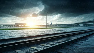
Every year, it’s the same story. The sky opens up, and within an hour, key arterial roads in Mumbai, Delhi, Bengaluru, and Chennai are transformed into small rivers. You’re stuck in traffic, anxiously watching the water level rise around your car’s tyres.
News channels show dramatic visuals of stalled vehicles and submerged underpasses. A 30-minute journey stretches into three hours, costing you time, fuel, and peace of mind, not to mention the risk of serious damage to your vehicle. Traditional weather forecasts can tell you it will rain, but they can't tell you if the service road by your office is currently two feet under water. This is where real-time, ground-level information becomes not just a convenience, but a crucial safety tool.
How Crowd-Sourcing Works Its Magic
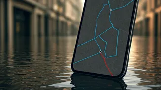
The solution lies in the concept of crowd-sourcing. Think of it as a massive, digital neighbourhood watch for traffic. When you use an app like Google Maps or Waze, your phone anonymously shares data about your location and speed. If thousands of phones in one area suddenly slow to a crawl or stop completely, the app’s algorithm correctly assumes there’s a traffic jam. But it goes deeper than that. These platforms also allow users—the 'crowd'—to actively report specific issues. By tapping a few buttons, drivers can flag accidents, road closures, and most importantly for our monsoon woes, flooding. When multiple users report the same thing, the system gains confidence in the data and alerts other drivers approaching the area. You are no longer driving blind; you are benefiting from the collective experience of hundreds of drivers ahead of you.
Your Primary Tools: Google Maps and Waze
For most Indian commuters, the two most powerful tools are already on their phones: Google Maps and Waze. Both use live, crowd-sourced data, but they have slightly different strengths. **Google Maps:** As the default navigation app for most Android users, it has an enormous user base, which means more data points. It automatically shows slowdowns with yellow, red, and dark red lines. A sudden patch of dark red on an otherwise clear day during a downpour is a strong indicator of a problem, very likely waterlogging. Users can also report incidents, including 'road closure' or 'stalled vehicle,' which appear as icons on the map. **Waze:** Owned by Google but operating as a separate community-focused app, Waze is built entirely around user reporting. Its interface is designed for quick, real-time alerts. Waze has a specific 'Flood' hazard reporting option, making it incredibly useful during the monsoon. You can also see how long ago an incident was reported, giving you a sense of how current the information is.
Practical Steps for a Safer Commute
Simply turning on the app isn’t enough. You need to use it actively. 1. **Check Before You Leave:** Don't wait until you're already on the road. Before starting your journey, input your destination and scrutinise the suggested route. Look for those dark red traffic lines and hazard icons. Check alternate routes; a slightly longer path might save you from a major waterlogged jam. 2. **Stay Alert While Driving:** Keep the app running in a hands-free mount. It will audibly announce major slowdowns or hazards ahead, giving you time to decide on a detour. 3. **Be a Good Digital Citizen:** If you safely pass a waterlogged area or see a stalled vehicle causing a blockage, report it. It takes just a few seconds (have a co-passenger do it if possible) and you’ll be helping countless others behind you. The more people who contribute, the more reliable the system becomes for everyone.
Beyond Apps: The Human Network
While apps are powerful, don't underestimate the power of hyper-local human intelligence. Many cities have dedicated Twitter handles (often run by traffic police or citizen groups) that post real-time updates with photos and videos of flooded areas. For example, following the Mumbai or Bengaluru Traffic Police on Twitter can provide official confirmation of major closures. Similarly, residential or community WhatsApp groups are often the first to report on localised flooding in back lanes and smaller streets that may not show up on major navigation apps immediately. Combining the tech of Waze or Google Maps with the hyper-local context from these human networks gives you the most complete picture.
A Word of Caution: Tech Isn't Perfect
These systems are incredible aids, but they are not infallible. The data is only as good as the most recent reports. A flash flood can occur in minutes, and it might take 15-20 minutes for the data to catch up. A reported 'flood' might have been a minor puddle that has since drained, or it could be a deep-water disaster. These apps are a guide, not a guarantee. The ultimate decision-making tool is your own judgement. If a route looks dangerously flooded, do not attempt to cross it, no matter what your app says. The old wisdom still holds true: it's better to turn around and be late than to risk your safety and your vehicle.