





A Landmark Partnership in the Sky
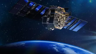
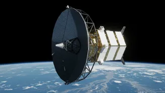
The NASA-ISRO Synthetic Aperture Radar (NISAR) mission is a groundbreaking collaboration between the two space agencies, representing one of the most significant joint projects to date. Launched in July 2025, the satellite is the first of its kind, equipped
with dual-frequency radars—the L-band from NASA and the S-band from ISRO. This powerful combination allows NISAR to comprehensively monitor changes on Earth's surface with incredible precision, down to centimetre-level shifts. Orbiting the Earth every 12 days, it provides a consistent and reliable stream of data, creating a detailed, dynamic map of our planet's land and ice. This mission isn't just a technological marvel; it's a testament to international cooperation in tackling global challenges like climate change and disaster management.
The Technology That Sees Through Clouds
What makes NISAR a game-changer for flood forecasting is its core technology: Synthetic Aperture Radar (SAR). Unlike traditional optical satellites that are effectively blind during the night or when there is heavy cloud cover, SAR can see through it all. It works by sending microwave signals to the Earth's surface and reading the signals that bounce back. This allows it to create high-resolution images day or night, in any weather—a critical advantage during the monsoon season when flood-hit regions are often obscured by clouds. The dual L- and S-band frequencies provide complementary information; the L-band can penetrate vegetation to see water pooling underneath, while the S-band is excellent for tracking surface water and soil moisture. This gives disaster managers an unprecedentedly clear and complete picture of a developing flood situation.
From Raw Data to Life-Saving Warnings
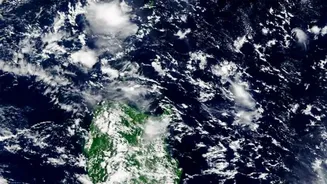
Capturing images is only the first step. The true innovation lies in how NISAR's data is transformed into actionable intelligence. The satellite generates a massive volume of data, which is processed and made available to scientists and disaster management agencies within hours or a couple of days. By comparing images taken on different days, analysts can create maps that clearly show flood inundation—which areas are currently underwater and how water levels are changing. Recent images from July 2026, for example, have provided detailed views of the Brahmaputra river basin in Assam, helping to map the extent of the floods affecting the region. This data is fed into hydrological models to forecast how a flood might spread, giving authorities a vital head start to issue evacuation warnings, position resources, and mitigate damage.
Real-World Impact for India
For a country where floods are a recurrent and devastating reality, the implications of NISAR are enormous. India has long used satellite data for disaster management, but NISAR's all-weather capabilities and frequent revisit time significantly enhance these efforts. States like Assam, Bihar, and Kerala, which frequently battle riverine and cyclonic floods, stand to benefit immensely. The ability to accurately map flooded croplands helps in assessing agricultural damage for insurance and relief purposes. Furthermore, by monitoring river channel shifts, erosion, and changes in wetlands, the data supports long-term mitigation planning, helping build more resilient infrastructure and communities. This proactive approach marks a shift from simply reacting to disasters to anticipating and preparing for them with precision.