


Beyond the National Forecast
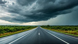
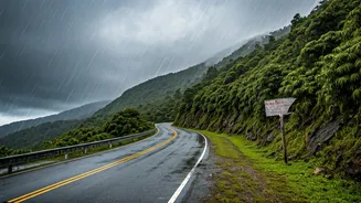
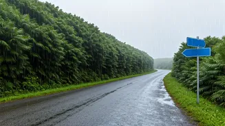
A broad forecast predicting rain for an entire state is useful, but it doesn't tell you about the microclimate of the specific valley or road you'll be on. Hill weather is notoriously fickle. Heavy rain in one area can trigger a landslide that blocks
a key highway, while a neighboring area remains perfectly clear. These localized events are what national forecasts miss. The real dangers during a monsoon trip aren't just getting wet; they are landslides, flash floods, and sudden road closures that can leave travellers stranded for hours or even days. Several popular destinations in Himachal Pradesh and Uttarakhand, like Shimla, Manali, and Mussoorie, are known to be vulnerable to such disruptions during periods of intense rain.
Your Go-To Sources for Ground Truth
To travel safely, you need to tap into local information networks. Before and during your trip, make it a habit to check the official social media accounts (especially Twitter/X and Facebook) of the state and district police. Departments in states like Himachal Pradesh and Uttarakhand often post real-time updates on road blockages, alternate routes, and travel advisories. The State Disaster Management Authority (SDMA) websites are another crucial resource, providing official notifications and emergency contacts. For example, the Uttarakhand Tourism Development Board recently issued an advisory urging visitors to check weather and road conditions before starting their journey. These official channels provide verified information that can help you make informed decisions.
Leverage Community-Driven Platforms
Beyond official sources, community-driven platforms can offer invaluable, on-the-ground insights. There are now websites and apps specifically created to provide real-time road status updates for states like Himachal Pradesh, powered by updates from fellow travellers and locals. These platforms can alert you to a freshly cleared landslide or a newly developed bottleneck that hasn’t yet made it to an official bulletin. Facebook groups and online travel forums dedicated to specific regions are also a treasure trove of information. A quick post asking about the condition of the road to, say, Kempty Falls in Mussoorie or the highway to Manali can yield instant replies from people who have just travelled that stretch.
Technology and Human Intelligence
While Google Maps is great for navigation, it may not always reflect the immediate ground reality of a landslide or a flash flood. However, its live traffic feature can give you clues about unusual slowdowns. Combine this with specialized apps designed for Indian road conditions, which can offer alerts for potholes and bad patches. But don't underestimate the power of human intelligence. Your hotelier, your taxi driver, and even local shopkeepers are often your best sources. Call your hotel a day before you travel and ask about the local road conditions. Your driver will likely be in touch with a network of other drivers, sharing constant updates on which routes are safe and which to avoid. This combination of tech and human insight is your strongest asset.
Planning for Flexibility
Ultimately, a successful monsoon hill trip is about preparation and flexibility. The goal isn't to avoid the rain but to respect its power. Always build buffer days into your itinerary. If a road is blocked, having an extra day means you can wait for it to clear without panicking. Avoid travelling at night when visibility is low and the risk of encountering a sudden blockage is higher. And if local authorities issue an orange or red alert, it’s wisest to postpone your travel plans or stay put. The beauty of the monsoon-drenched hills will still be there when the roads are safe to travel.