





The First Theory: A Complete Break
When the magnitude 7.8 earthquake struck Nepal on April 25, 2015, the immediate scientific consensus pointed to a massive rupture along the Main Himalayan Thrust (MHT). This is the colossal fault where the Indian tectonic plate pushes beneath the Eurasian
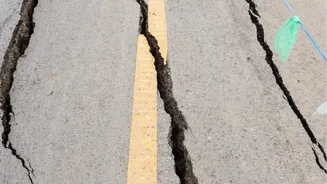
plate, a slow-motion collision that builds the Himalayan mountains. The initial theory was straightforward: a huge section of this fault had slipped, causing the devastating shaking that killed nearly 9,000 people and was felt across northern India. Scientists expected that such a powerful quake would have ruptured the ground surface, creating a visible scar where the fault broke through. This is a common feature in large thrust earthquakes, like the 1934 Bihar-Nepal earthquake, where the fault reached the surface.
A Puzzling Lack of Evidence
In the days and weeks after the quake, geologists, including teams from the USGS and other international bodies, scoured the region for the expected surface rupture. They found nothing. Despite the immense energy released, the fault had not broken through to the surface. This was a major puzzle. The ground had shaken violently, Mount Everest had shifted, and tens of thousands of landslides were triggered, yet the primary fault remained buried. This critical missing piece of evidence suggested the initial, simple theory of a complete break was wrong. It meant that only a part of the fault had slipped, deep underground, leaving a more complex and potentially more dangerous situation than first realized.
Advanced Data Reveals a Deeper Truth
The mystery began to unravel thanks to modern technology. Scientists used Interferometric Synthetic Aperture Radar (InSAR), a satellite-based technique that can detect centimetre-level changes in ground elevation, alongside a network of high-precision GPS receivers. This data allowed them to create a detailed map of how the ground had deformed. The picture that emerged was not of a single, clean break. Instead, the data showed that the earthquake had ruptured a deep, locked section of the Main Himalayan Thrust, roughly 15 km underground. The rupture propagated eastward for about 150 km, directly under the region toward Kathmandu, but it stopped before it reached the shallowest part of the fault near the Himalayan foothills.
The Revised Theory: A Partial Rupture
This led to the revised theory, supported by the USGS and the broader scientific community. The 2015 Gorkha earthquake was not a complete rupture of the fault segment, but a partial one. It unzipped a deeper portion of the Main Himalayan Thrust but left the shallower, frontal section locked and unruptured. Think of it like a zipper that only opens halfway. The earthquake released immense stress deep below the surface but, in doing so, it may have transferred that stress to the upper, still-stuck portion of the fault. This explained the lack of a surface break and also the pattern of aftershocks, which mostly occurred to the east of the main rupture, including a major magnitude 7.3 event 17 days later.
Why This Revision Matters for India
This revised understanding has profound implications for the entire Himalayan region, including North India. The fact that the 2015 earthquake did not release all the accumulated strain means that the frontal part of the fault system remains locked and loaded with an estimated 3.5 meters of pent-up strain. This unruptured section is now under increased stress, potentially setting the stage for a future great earthquake of magnitude 8 or higher. Such an event could rupture all the way to the surface, releasing even more energy than the Gorkha quake. This scientific revision wasn't just an academic correction; it was a stark warning. It highlighted a specific, well-defined hazard and underscored the urgent need for preparedness in one of the world's most seismically active regions.