







From a Single Vial to a Global View
For decades, assessing the health of our rivers, lakes, and oceans was a painstaking and localised process. It involved sending teams to collect physical samples, which were then transported to labs for analysis. This method, while accurate, is slow,
expensive, and provides only a snapshot of a tiny area at a single moment in time. For a country with vast water resources like India, from the Himalayas to the Indian Ocean, this approach makes it nearly impossible to get a comprehensive, real-time picture of water health. You can test a river at one point, but miss a pollution event happening just a few kilometres upstream. This reactive approach has always left water managers one step behind.
Our Eyes in the Sky
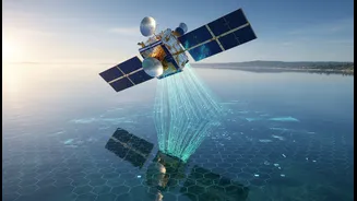
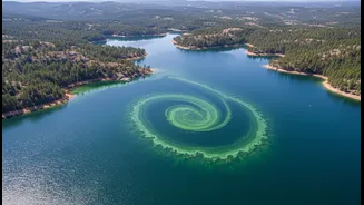
The game-changer has been the advent of advanced remote sensing technology. A new generation of Earth-observation satellites is now circling the globe, equipped with powerful sensors that can 'see' the quality of the water below. Missions like NASA’s recently launched PACE satellite and the EU’s Copernicus Sentinel series carry instruments called hyperspectral imagers. These devices can detect hundreds of different colours of light reflecting off the water's surface. By analysing these unique light signatures, scientists can identify and map key water quality indicators like chlorophyll concentration (a sign of algal blooms), sediment plumes from rivers, and even the presence of certain pollutants over vast areas. Instead of a single vial, we now get a detailed map of an entire coastline or river basin, often on a daily basis.
The Brains of the Operation: AI
Collecting this colossal amount of data from space is only half the battle; making sense of it is the other. This is where Artificial Intelligence (AI) and machine learning come in. AI algorithms are trained to sift through petabytes of satellite imagery and sensor data, identifying patterns that the human eye would miss. These systems can correlate water discolouration with land-based activities to pinpoint potential sources of pollution, predict where a harmful algal bloom might drift next, and even forecast future water quality issues based on weather patterns and historical data. By integrating data from multiple sources, AI transforms a flood of information into actionable intelligence for water managers, moving from simple monitoring to predictive management.
Smart Sensors on the Ground
While satellites provide the big picture, a network of smart, connected sensors on the ground provides the critical, high-frequency details. These Internet of Things (IoT) devices are the modern, automated version of the field scientist. Deployed in rivers, reservoirs, and industrial outflow pipes, these sensors continuously measure parameters like pH, turbidity, temperature, and dissolved oxygen in real-time. This constant stream of data is vital for validating what satellites observe and for catching sudden pollution events the moment they happen. When a sensor detects an anomaly, it can trigger an immediate alert, allowing authorities to respond in hours instead of weeks. This combination of 'eyes in the sky' and 'boots on the ground' creates a comprehensive, multi-layered monitoring system.
The Impact on India and the World
For nations facing significant water stress and pollution challenges, this technological leap is transformative. In India, programs like the National Mission for Clean Ganga and the Jal Jeevan Mission stand to benefit immensely. Authorities can now monitor industrial discharge more effectively, track the impact of cleanup efforts with unprecedented detail, and provide early warnings to communities that rely on rivers for their drinking water. This technology also optimises water usage in agriculture by monitoring soil moisture and crop health from space, helping conserve precious resources. It empowers a shift from slow, reactive cleanups to a proactive, predictive, and intelligent governance of one of our most vital resources, safeguarding public health and ecosystems for the future.