








A Global Mission in a Small Package
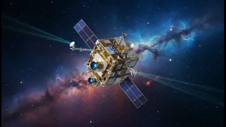
On July 7, 2026, a SpaceX Falcon 9 rocket carried a unique payload into orbit: the Geodetic Reference Instrument Transponder for Small Satellites, or GRITSS. While its name is a mouthful and its size is modest, its mission is one of immense importance.
Developed by NASA in collaboration with partners like the University of Massachusetts Lowell and Dutch manufacturer ISISPACE, GRITSS is not a new navigation system or another weather satellite. Instead, its job is to perform cosmic-level housekeeping by improving the accuracy of the International Terrestrial Reference Frame (ITRF). The ITRF is the planet's fundamental coordinate system, a global grid that underpins virtually all space-based and ground-based observations of Earth. By making this foundational grid more precise, GRITSS will have a ripple effect across numerous scientific and commercial fields.
Unifying Three Different Views of Earth
For decades, scientists have built our understanding of the Earth's shape, orientation, and gravity field by combining data from three distinct and powerful techniques. These are the Global Navigation Satellite System (GNSS), which includes familiar constellations like GPS; Very Long Baseline Interferometry (VLBI), which uses networks of radio telescopes to observe distant quasars; and Satellite Laser Ranging (SLR), which bounces lasers off orbiting objects. Each system is incredibly precise, but they all have their own reference points. The challenge has always been tying them together perfectly. Minor discrepancies, known as "site tie" errors, arise when combining their data, introducing uncertainties on the scale of millimeters. While that may sound trivial, these millimeters are the difference between noise and a clear signal when measuring critical planetary changes.
A Clever Transponder in the Sky
This is the problem GRITSS was designed to solve. It acts as a single, unified target in space that can be observed by all three geodetic systems simultaneously. It achieves this through a clever piece of engineering. The CubeSat carries a specialized GPS receiver that captures navigation signals from orbit. Onboard processors then immediately upconvert and re-broadcast those signals in S-band and X-band frequencies, which are the same frequencies that the global network of VLBI radio telescopes use. In essence, it acts as a translator, allowing the GNSS and VLBI systems to talk to each other through a common reference point. At the same time, GRITSS is equipped with a laser retroreflector array—a sophisticated mirror—that allows ground-based SLR stations to bounce laser beams off it to measure its precise distance. By serving as a bridge between these three independent networks, GRITSS helps eliminate the systemic errors that have limited the ITRF's accuracy.
Precision That Matters for Climate Science
The primary beneficiary of this newfound precision is climate science. The Earth Science Decadal Survey has a long-standing goal of achieving 1-millimeter accuracy for the ITRF, a target that GRITSS is designed to help meet. A hyper-accurate reference frame is essential for confidently tracking the subtle but relentless changes our planet is undergoing. It allows scientists to measure sea-level rise, the melting of ice sheets in Greenland and Antarctica, the shifting of tectonic plates, and changes in global water resources with unprecedented certainty. This enhanced accuracy will sharpen our understanding of complex ocean-climate cycles like El Niño and provide a more stable, reliable baseline for all future Earth science missions that monitor our planet's health.
Redefining 'You Are Here'
While the primary mission of GRITSS is scientific, its impact will extend to the world of navigation and mapping. The ITRF is the invisible scaffolding upon which all positioning services are built, from the GPS in your car to the advanced systems guiding autonomous vehicles and aircraft. By refining this underlying framework, GRITSS will enable more robust and accurate positioning globally. It promises to push geodetic-quality GPS capabilities, once the domain of large, expensive satellites, into a compact CubeSat form factor. This will support the development of next-generation topography missions that can map our world in higher fidelity, leading to better resource management, urban planning, and disaster response.