




A Paradise on the Brink
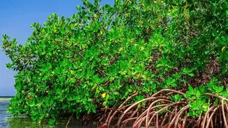
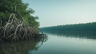
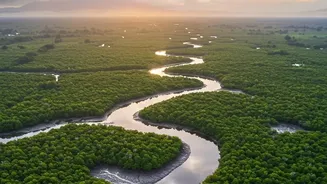
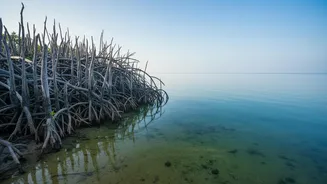
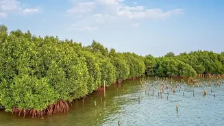
Stretching across India and Bangladesh, the Sundarbans is the world's largest mangrove forest, a UNESCO World Heritage Site, and a vital buffer protecting millions of people from the full force of cyclones. This unique ecosystem, home to the elusive Bengal
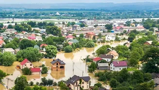
tiger, is defined by the rhythm of the tides. However, this rhythm is becoming increasingly dangerous. Sea levels in the Sundarbans are rising at more than twice the global average, and the frequency of severe cyclones has surged. Cyclones like Aila and Amphan have left deep scars, causing widespread destruction, inundating agricultural land with saltwater, and forcing thousands from their homes. For the 4.5 million people in the Indian Sundarbans, the threat of tidal flooding is a constant, existential reality.
Technology as a Digital Watchtower
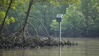
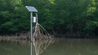
In response to this escalating crisis, researchers and government agencies are turning to technology. The latest initiative involves a network of telemetry sensors strategically placed throughout the delta's intricate network of rivers and creeks. Think of it as a sophisticated, 24/7 digital watchtower for the entire region. Instead of relying solely on broad weather forecasts or manual observations, which often come too late, this system provides a continuous stream of hyperlocal data. This information is crucial for understanding how water moves through the delta in real-time, offering an unprecedented level of detail for disaster management authorities.
How the Sensors Work
The term 'telemetry' simply means collecting data from remote points and transmitting it to a central receiver for monitoring and analysis. In the Sundarbans, these hardy, weatherproof sensors are equipped to measure a range of critical environmental factors. These include the water level, the speed and direction of the current, water salinity (the salt content), and turbidity (how cloudy the water is). This data is then transmitted wirelessly, often using cellular or satellite networks, to a central data processing centre. This constant flow of information creates a dynamic, live map of the region's complex hydrology, something that was previously impossible to achieve.
From Data to Life-Saving Decisions
Collecting data is only the first step. The true power of this system lies in how the information is used. The incoming data from the sensors is fed into advanced computer models that can predict how a tidal surge will behave. These models can identify which specific areas are most at risk of being inundated, how high the water will get, and when it will arrive. This allows for a far more effective and targeted response. Instead of issuing a general alarm for the entire region, authorities can send specific warnings to the most vulnerable villages. This precision can mean the difference between chaos and an orderly evacuation, giving residents crucial extra hours to move to cyclone shelters and secure their property. It also helps officials make better decisions about managing embankments and sluice gates to mitigate damage.
A New Era of Preparedness
This sensor-based approach marks a significant evolution in early warning systems. In the past, communities often relied on informal networks, like family members or neighbours, for alerts. While community knowledge is invaluable, technology adds a layer of speed and scientific accuracy that is essential when dealing with fast-moving storm surges. Combining high-tech monitoring with low-tech, community-based communication channels—like village loudspeakers and door-to-door announcements by volunteers—ensures that warnings reach everyone, including the elderly and those without access to mobile phones. Several pilot projects have already demonstrated the effectiveness of integrating modern technology with local knowledge to enhance resilience.
The Challenges Ahead
Despite its immense potential, the system is not without challenges. The harsh, saline environment of the Sundarbans is tough on sensitive electronic equipment, requiring regular and difficult maintenance. Ensuring the network has enough sensors to cover the vast, 10,000-square-kilometre delta is a significant financial and logistical undertaking. Furthermore, the ultimate success of the project depends on ensuring that the life-saving information reaches the last mile—the most isolated and vulnerable communities living deep within the mangrove islands. Bridging this communication gap remains a critical priority for a comprehensive disaster management strategy.