






A New Perch in the Heavens
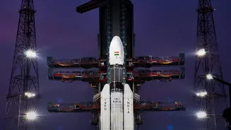
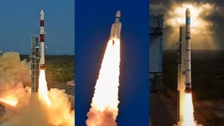
On September 4, 2026, the Indian Space Research Organisation (ISRO) successfully launched the EOS-05 satellite aboard its GSLV-F17 rocket. This wasn't just another launch; it marked India's first-ever placement of a dedicated imaging satellite into a geosynchronous
orbit (GEO), approximately 36,000 kilometres above the Earth. Unlike most Earth observation satellites that circle the planet in low-Earth orbit (LEO) and pass over a location intermittently, a satellite in GEO matches the Earth's rotation. This allows EOS-05 to maintain a constant watch over the Indian subcontinent and its surrounding regions, providing near real-time imagery of a massive geographical area. This persistent monitoring capability is a game-changer, overcoming a key limitation of LEO satellites for tracking rapidly evolving events. The success was particularly significant as it came after a previous attempt to place a similar satellite, EOS-03, failed in 2021.
A Quantum Leap in Capability
Described as a state-of-the-art spacecraft, EOS-05 is designed for high-impact applications. Its ability to provide continuous updates is invaluable for tracking fast-moving weather systems like cyclones, monitoring the spread of forest fires, and mapping flood-affected areas as the situation unfolds. For disaster management agencies, this translates into quicker, more informed decisions that can save lives and direct relief efforts more effectively. The satellite carries advanced multispectral imagers capable of capturing detailed images across different light bands, which helps in assessing everything from vegetation health to water quality. This mission also saw the GSLV rocket launch its heaviest payload to date, at 2,367 kg, demonstrating ISRO's growing capacity to handle more complex and powerful satellites.
Powering a Smarter Agricultural Sector
Beyond disaster response, the data from EOS-05 is set to transform India's vast agricultural landscape. Earth observation data is already a critical tool for monitoring crop health, predicting yields, and managing resources. The persistent, wide-area view offered by EOS-05 will provide unprecedented insights. Farmers and policymakers can get a continuous read on crop conditions, soil moisture levels, and the impact of weather patterns over large regions. This enables more effective implementation of precision agriculture techniques, helping to optimize the use of water and fertilizers, which boosts productivity and supports food security for the nation. The same data is also vital for urban planning, allowing authorities to monitor urban sprawl, manage land use, and oversee the development of critical infrastructure like roads and pipelines.
A Strategic Eye for National Security
While ISRO has emphasized its civilian benefits, the dual-use nature of such a powerful Earth observation platform is undeniable. ISRO's chairman noted the satellite would provide crucial "strategic data" for the country. The ability to continuously monitor regions of interest along India's vast land borders and extensive coastline offers a significant advantage for national security. This capability enhances situational awareness and allows for the persistent surveillance of strategic locations and maritime activities. While not a "spy satellite" in the traditional sense, the wide-area persistence provides a layer of security and intelligence that complements the high-resolution, targeted imagery from satellites in lower orbits, bolstering India's strategic autonomy.