


The Surprising Connection
When clouds gather over Delhi, Punjab, or Haryana, it’s natural to look west for the source. But in many cases, the culprit—or the saviour, depending on your perspective—lies far to the southeast. The Indian weather system is a vast, interconnected engine.
A weather event in one corner of the country can be a direct consequence of conditions in another. The recent wet spells bringing unseasonal or intense rain to the northwestern plains are a classic example of this long-distance relationship. The key players in this drama are the warm waters of the Bay of Bengal and the upper-air weather systems that traverse the subcontinent, creating a moisture pipeline that stretches across the heart of India.
An Atmospheric River from the Bay
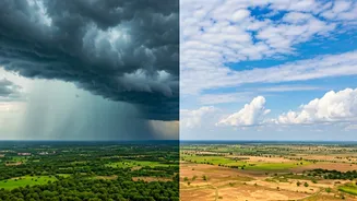
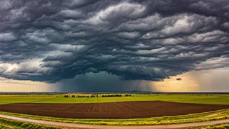
It all begins with a low-pressure area or depression forming over the Bay of Bengal. These systems act like giant, rotating pumps. They draw in vast amounts of moisture from the warm sea surface, pulling it high into the atmosphere. Fueled by this energy, strong easterly or southeasterly winds begin to blow inland. Think of it as a river, but in the sky—a concentrated band of moisture flowing from the sea towards the land. This moisture-laden air mass doesn't just stay in the east; it embarks on an epic journey westward, crossing states like Odisha, Chhattisgarh, and Madhya Pradesh as it moves towards the northern plains.
Guided by the Monsoon Trough
This atmospheric river doesn’t wander aimlessly. It is often guided by a major feature of the Indian Summer Monsoon: the monsoon trough. This is an elongated area of low pressure that typically extends from northwest Pakistan, across the Gangetic plains, to the head of the Bay of Bengal. The position of this trough is crucial. When it is in its normal or a southerly position, it acts as a highway for the moisture-rich winds from the Bay. The winds follow this path of least resistance, channelling the moisture directly towards Northwest India. This process effectively transports the humidity of the coast to the historically drier inland regions.
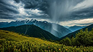
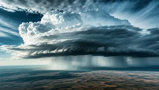
The Final Trigger: Western Disturbances
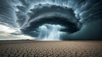
Just having moisture is not enough to cause heavy rain. You need a trigger—a mechanism to force that moist air to rise, cool, and condense into clouds and precipitation. This is where Western Disturbances come in. These are extratropical storms originating in the Mediterranean region that move eastwards. When a Western Disturbance—an upper-air trough of low pressure—moves over Northwest India, it interacts with the moisture-laden easterly winds from the Bay of Bengal. This interaction provides the necessary upward lift. The warm, moist air is forced to ascend rapidly, leading to the formation of dense clouds and, consequently, widespread and often intense rainfall over the region.
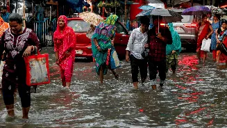
Impact on the Ground
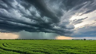
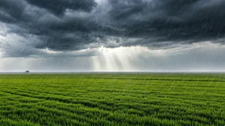
The result of this continental-scale weather ballet is what people on the ground experience as a 'massive wet spell'. Temperatures drop, providing relief from pre-monsoon heat or post-monsoon dryness. However, it can also lead to significant problems. In cities like Delhi and Chandigarh, intense bursts of rain can overwhelm drainage systems, causing widespread waterlogging and traffic chaos. For farmers, the timing is everything. While such rain can be beneficial for replenishing soil moisture for the Rabi crop sowing season, unseasonal heavy showers can also damage mature Kharif crops like paddy and cotton that are ready for harvest. It's a delicate balance of benefit and risk, all dictated by winds that began their journey hundreds of kilometres away.