


Why Southern Highways Demand Respect
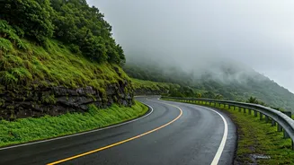
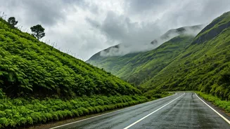
Driving in South India, especially during and after the monsoon, is a unique experience. The geography of the Western Ghats and the Deccan Plateau creates fast-moving, unpredictable weather systems. Unlike the steady drizzles you might find elsewhere,
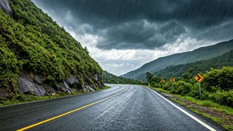
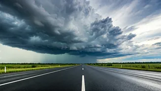
southern rain can arrive as a sudden, intense cloudburst that drastically reduces visibility and can quickly lead to waterlogged patches on the road. Highways like the NH 66 along the coast or the NH 44 cutting through the peninsula are beautiful but notorious for these sudden changes. A clear sky can turn into a wall of water in minutes, making proactive weather tracking not just a convenience, but a critical safety measure.
Your Essential Digital Toolkit
Forget generic weather reports. For real-time highway planning, you need tools that show you what’s happening right now and what’s coming next. Your primary weapon should be a weather app with a reliable Doppler radar feature.
Start with the official source: the 'Mausam' app by the India Meteorological Department (IMD). Its key strength is direct access to the national radar network, offering unparalleled accuracy for tracking rain formations over the subcontinent. For a more user-friendly interface or a second opinion, consider international leaders like AccuWeather or The Weather Channel. These apps often provide excellent minute-by-minute precipitation forecasts ('rain starting in 15 minutes') that are incredibly useful for deciding whether to pull over for a quick tea break or press on.
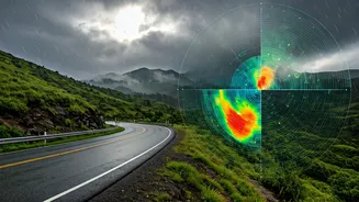
How to Read a Weather Radar Like a Pro
Opening the radar map can feel intimidating, but it’s simpler than it looks. The map shows precipitation intensity through colours. Light green indicates light drizzle, while yellow and orange signify moderate, steady rain. The colours you really need to watch for are red, pink, and purple—these represent intense downpours, thunderstorms, and potential hail.
The most powerful feature is the loop or animation function. By playing the last hour of radar imagery, you can see the direction and speed of the rain clouds. Is a large red patch moving directly towards your route on the highway? Or is it moving parallel, likely to miss you? Understanding this movement is the key to making smart decisions. It allows you to estimate whether a storm is a brief 15-minute affair or a prolonged, hours-long event that warrants a longer stop.
Turning Data into Driving Decisions
Technology is useless without strategy. Here’s how to translate radar data into on-road action. Before you start your day's drive, check the radar for any large systems brewing. If possible, plan your travel for the morning, as convective thunderstorms often build with the heat of the afternoon.
While driving, use the 'near me' radar function every hour or so, especially if you see skies darkening ahead. If you see a small, fast-moving yellow patch coming your way, you might just need to slow down for 20-30 minutes. If a large, slow-moving red system is blocking your path, it’s a clear signal to find a safe, well-lit restaurant or rest area and wait it out. Trying to 'punch through' a severe storm is a high-risk gamble that can lead to hydroplaning, getting stranded in a waterlogged area, or worse.
Beyond the App: On-the-Ground Wisdom
Your phone is a tool, not a crystal ball. Always supplement the digital forecast with real-world observation. Pay attention to the sky, watch for sudden drops in temperature, and notice how local drivers are behaving—if they start pulling over, it’s usually for a good reason. Before any monsoon trip, ensure your car is prepared. This means checking that your tyre treads are deep enough to handle wet roads, your wiper blades are new and effective, and all your lights (headlights, taillights, and fog lamps) are working perfectly. Most importantly, when the rain starts, your first action should always be to reduce your speed and double the distance between you and the car in front. A perfect trip is, above all, a safe one.