







The Big Picture: What the IMD is Forecasting
The latest forecast from the India Meteorological Department points to a vigorous monsoon spell affecting large parts of the country. A deep depression that formed over the Bay of Bengal has moved inland, bringing widespread heavy to extremely heavy rainfall.
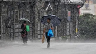
This weather system is expected to travel west-northwest across Odisha, Jharkhand, and Chhattisgarh over the next 24 hours. The IMD predicts that this active phase will bring normal to above-normal rainfall to northwest and central India for the next several days. The combination of this depression, an active monsoon trough, and other atmospheric conditions is leading to intense showers, thunderstorms, and strong winds. Authorities have warned that this could lead to waterlogging in cities, flash floods, and potential landslides in hilly regions.
Regions on High Alert
Several states are under specific warnings. The IMD has forecast heavy to extremely heavy showers for Delhi, Maharashtra, Gujarat, Karnataka, Rajasthan, Odisha, Jharkhand, and Chhattisgarh. Extremely heavy rainfall has already been observed in isolated parts of Odisha. Alerts for very heavy rain are also in place for Vidarbha, West and East Madhya Pradesh, and the Konkan & Goa region. In the north, Himachal Pradesh and Uttarakhand are at risk of moderate flash floods and landslides, with several districts specifically named in alerts. Similarly, northeastern states like Assam and Meghalaya are expected to see continued rainfall. Even areas with lighter predicted rainfall are not entirely in the clear, with thunderstorms and gusty winds of up to 70 kmph forecast for some coastal regions like Odisha and Andhra Pradesh.
Advice for Road and Rail Travellers
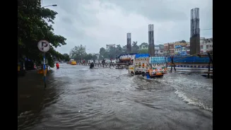
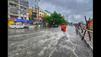
If you are planning to travel by road, extreme caution is advised. The IMD has explicitly warned of disruptions to road traffic due to waterlogging and reduced visibility. Major routes like National Highway 44 may experience slowdowns. In urban areas like Delhi, heavy rains have already led to significant waterlogging on key roads, causing traffic snarls. For those heading to hill stations, particularly in Uttarakhand and Himachal Pradesh, the risk of landslides is high, which could lead to road closures. It is essential to check local traffic advisories and road conditions before starting your journey and to avoid driving into waterlogged areas. While Indian Railways generally remains reliable during the monsoon, it's wise to build buffer days into your schedule, especially for routes passing through heavily affected regions.
Impact on Air Travel
Air travel is also likely to be affected. Airlines have issued travel advisories for passengers, warning of potential delays and rescheduling at major airports like Delhi's IGI Airport and Chandigarh. Low visibility and strong winds can impact runway operations, as seen in previous monsoon spells where flights were delayed or diverted. Before heading to the airport, confirm your flight status directly with the airline. Given the possibility of sudden weather changes, it's a good practice to have extra time for your airport commute and connections. Keeping your electronic devices, including a power bank, fully charged is crucial in case of extended delays at the airport.
Essential Safety Checklist
Staying prepared is your best defence. Travellers are strongly advised to monitor official weather updates from the IMD. Avoid waterlogged streets and low-lying areas. If you are in a hilly region, be vigilant for signs of landslides and be prepared to move to a safer location if advised by local authorities. Pack a waterproof bag for your electronics and important documents. A basic first-aid kit, along with any necessary medications, is also a must-have. Inform your family or friends about your itinerary and keep them updated on your whereabouts. Finally, maintain flexibility in your travel plans; in severe weather, postponing a part of your journey might be the safest option.