





A Labyrinth of Water
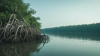
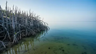
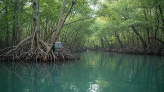
The Sundarbans is a vast, intricate network of rivers, creeks, and channels intersecting thousands of square kilometres of forest. This entire ecosystem is dictated by the twice-daily ebb and flow of tides from the Bay of Bengal. Unlike a simple coastal
tide, the water here funnels through a maze of waterways, creating complex patterns of flow, water level changes, and salinity shifts that are difficult to predict. The flat topography means huge areas get inundated daily, but the depth can vary significantly from place to place. This constant flux is the lifeblood of the mangroves, distributing nutrients and sediment, but it also makes on-the-ground study incredibly difficult and dangerous.
Eyes and Ears in the Water
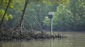
To solve this puzzle, scientists have turned to technology. The key tool is telemetry. In this context, telemetry involves placing specialised sensors at strategic locations throughout the estuaries. These are not the same as radio collars on tigers, which also use a form of telemetry, but are stationary devices designed for hydrological monitoring. These robust sensors are built to withstand the harsh, saline environment and continuously record data. They act as automated, remote field assistants, collecting information 24/7 without needing a human present. The data is then transmitted, often wirelessly, to a central database for analysis, providing a real-time stream of information from the heart of the mangrove maze.
Decoding the River's Pulse
What are these sensors actually measuring? Primarily, they track key hydrological parameters. This includes water level, which is recorded at frequent intervals (sometimes every 15 minutes) to capture the full tidal cycle from high to low tide. They also measure water salinity—the concentration of salt—which is a critical factor for mangrove health. Reduced freshwater flow from upstream rivers has led to increasing salinity, threatening certain mangrove species. Other parameters often monitored are water temperature, flow velocity (how fast the water is moving), and turbidity (how much sediment is in the water). Together, this data paints a detailed, dynamic picture of the water's behaviour across the vast delta.
Unlocking Critical Insights
This continuous stream of data is invaluable. By analysing tidal amplification—how the height of the tide increases as it moves inland—scientists can understand how and where coastal energy is dispersed. This is crucial for modelling the impact of storm surges, which are a major threat to the region. The data also helps track sediment transport—the process of erosion and accretion that builds and reshapes the islands. Understanding where land is being lost and where it is being built up is essential for conservation and protecting the communities that live on the delta's edge. Furthermore, monitoring salinity trends helps predict how the forest composition might change over time, as some mangrove species are more salt-tolerant than others.
From Data to Long-Term Preservation
Ultimately, the information gathered by telemetry sensors feeds into larger predictive models. These models help forecast the long-term impacts of climate change, including sea-level rise and the increasing intensity of cyclones. This allows authorities to make more informed decisions about conservation strategies, embankment management, and early-warning systems for the millions of people who depend on the Sundarbans for their livelihoods and protection. By providing a clear, data-driven understanding of the Sundarbans' hydrological heartbeat, telemetry sensors are not just a scientific tool; they are a vital component in the effort to preserve this UNESCO World Heritage Site for generations to come.