



A New Eye In The Sky
Launched in July 2025, the NISAR satellite is a monumental collaboration between the Indian Space Research Organisation (ISRO) and the National Aeronautics and Space Administration (NASA). It stands as the most sophisticated Earth-observation satellite ever
launched, designed with a specific purpose: to track changes on our planet's surface with remarkable precision. Unlike optical satellites that are essentially cameras in space, reliant on sunlight and clear skies, NISAR uses advanced radar technology. This allows it to peer through clouds, smoke, and the dark of night, scanning nearly all of Earth’s land and ice twice every 12 days. This consistent, all-weather capability is a game-changer for environmental monitoring, especially in a country like India with its dramatic monsoon seasons that can obscure landscapes for months.
Seeing the Forest and the Trees
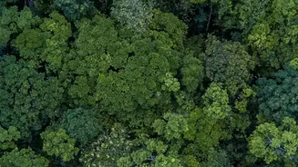
What truly sets NISAR apart is its use of two different radar frequencies, L-band and S-band. Think of it like having two types of X-ray vision. The shorter S-band waves, provided by ISRO, penetrate the top layer of the forest canopy, giving insights into the density of leaves and upper branches. The longer L-band waves from NASA dive deeper, piercing through the canopy to measure the structure of tree trunks and even detect moisture on the forest floor. This dual-frequency approach provides a three-dimensional understanding of forest health that was previously impossible from space. It can distinguish between a dense, healthy forest and an area that is slowly thinning out due to degradation, logging, or disease—changes that older satellites might miss entirely. It can even help identify waterlogged forests and wetlands hidden beneath dense tree cover.
India's Forests in High Definition
Since becoming operational and entering its science phase, NISAR has been systematically gathering data over the Indian subcontinent. ISRO began releasing S-band data products in July 2026, giving scientists their first taste of the satellite's power. Early imagery from regions like the Brahmaputra River basin has already demonstrated the satellite's ability to differentiate various land covers with incredible clarity—distinguishing between river channels, vegetated floodplains, and surrounding forests. For the first time, officials can get near-real-time, high-resolution maps showing subtle shifts in forest biomass, the extent of deforestation, and the progress of afforestation projects. This detailed mapping is crucial for vulnerable ecosystems like the Himalayan foothills and coastal mangroves, which are on the front lines of climate change.
From Data to On-the-Ground Action
This torrent of data—about 80 terabytes daily—is more than just pretty pictures. It provides actionable intelligence for a range of critical applications. Forest departments can use the maps to pinpoint the exact locations of illegal logging or track the spread of forest fires, even through smoke. The data will vastly improve the country's ability to estimate its carbon stock, a key component of India’s climate commitments, which include creating a massive carbon sink through forest and tree cover. Furthermore, by monitoring changes in land stability, NISAR can provide early warnings for landslides in mountainous regions, potentially saving lives. The mission's ability to track soil moisture also has profound implications for agriculture and water resource management across the country.