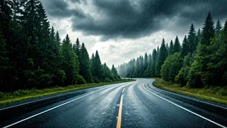


Why Traditional Forecasts Fall Short
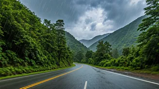
We all check the weather forecast before a long drive, especially during the monsoon. But official reports from agencies like the India Meteorological Department (IMD) often provide a macro view. They can tell you if heavy rain is expected in your district,
but they can’t tell you if the service lane near the Gurgaon underpass is flooded *right now*, or if a fallen tree is blocking a key road in Bengaluru. This is the information gap where hyperlocal, real-time updates become not just a convenience, but a critical safety tool. The difference between a safe journey and a stranded one often lies in knowing the condition of the exact road you plan to take, minute by minute.
The Power of the Crowd
This is where crowdsourced intelligence shines. For years, savvy Indian drivers have turned to online communities to share and receive hyper-local information. These are not professional meteorologists, but everyday people—truck drivers, sales executives, families on vacation—who are on the roads and sharing what they see. Online automotive forums, particularly platforms like Team-BHP, have dedicated threads that become buzzing hubs of activity during the monsoon. Members post pictures, videos, and text updates about road closures, waterlogging levels, alternative routes, and even safe places to stop. This collective knowledge creates a dynamic, living map of the road network that is often more current than any official source.
Key Forums and Groups to Follow
The go-to destination for many is the ‘Team-BHP’ forum, which has extensive, state-wise threads on road conditions that are constantly updated by its large and dedicated user base. Beyond this, Facebook has become an invaluable resource. Search for groups like “Roads and Highways of India” or city-specific traffic groups (e.g., “Pune Traffic Updates”). Even travel and regional groups become active with road condition queries during peak travel seasons. On platforms like X (formerly Twitter), following local traffic police handles and searching for relevant hashtags can yield immediate updates. The key is to find active communities where information is being shared by multiple users, increasing its reliability.
How to Vet Information
The biggest challenge with crowdsourced data is its reliability. Not all information is accurate or current. To avoid being misled, follow a few simple rules. First, look for recency. An update from two hours ago is far more valuable than one from yesterday. Second, seek confirmation. If one person reports a roadblock, wait to see if others in the thread or group confirm it. Photos and videos with timestamps are more trustworthy than simple text posts. Be wary of sensationalism or forwarded messages on WhatsApp, which are often outdated or entirely fake. Cross-reference what you’re seeing on forums with live traffic data from Google Maps or Waze to get a more complete picture.
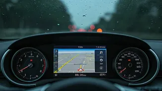
Beyond Forums: Your Digital Toolkit
Crowdsourced forums are one part of a modern driver’s toolkit. They should be used in conjunction with other digital tools. Google Maps and Waze are essential for their live traffic layers, which use anonymous location data from phones to show slowdowns. While they might not tell you *why* there’s a jam, a sudden patch of deep red on your route is a clear warning sign. Additionally, official apps like the IMD’s ‘Mausam’ and ‘Umang’ apps can provide district-level weather alerts and warnings, helping you understand the broader weather pattern you’ll be driving into. The smartest approach is to layer these sources: use official apps for the big picture and crowdsourced forums for the on-the-ground reality.