




Meet the Six-Satellite Sentinels
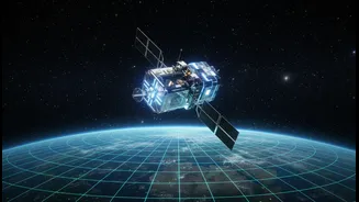
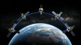
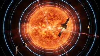
The “six satellites” in question form the FORMOSAT-7/COSMIC-2 constellation, a groundbreaking joint mission between Taiwan and the United States. Launched together in 2019 aboard a SpaceX Falcon Heavy rocket, these six spacecraft were meticulously placed
into low-Earth orbit to begin their vital work. The project is a collaboration between Taiwan's National Space Organization (TASA) and U.S. agencies like the National Oceanic and Atmospheric Administration (NOAA) and the U.S. Space Force. This international partnership built upon the success of a previous mission to create a next-generation system for observing our planet's atmosphere. By February 2021, all six satellites had reached their final operational orbits and began their coordinated mission to provide a constant stream of high-quality data.
A Symphony of Radio Waves
These satellites don't use cameras in the traditional sense. Instead, they perform a clever technique called GNSS Radio Occultation (RO). Here's how it works: the six COSMIC-2 satellites orbit the Earth and constantly listen for signals from Global Navigation Satellite System (GNSS) constellations, like GPS. As a signal from a GNSS satellite passes through Earth’s atmosphere before reaching a COSMIC-2 satellite, it gets slightly bent and slowed down. By measuring this tiny change—the bending angle—scientists can calculate precise profiles of atmospheric temperature, pressure, and moisture content from the surface up to the stratosphere. Having six satellites means they can collect over 5,000 such profiles daily, creating a dense, detailed picture of the atmosphere, especially over data-sparse areas like oceans. This symphony in orbit provides a level of coverage a single satellite could never achieve.
Better Forecasts for India
While a US-Taiwan mission, the data from COSMIC-2 is a game-changer for weather prediction globally, including right here in India. The detailed atmospheric data significantly improves the accuracy of numerical weather models used for forecasting. This is particularly crucial for predicting the formation, intensity, and track of tropical cyclones in the Arabian Sea and the Bay of Bengal. Accurate, timely warnings are essential for saving lives and property. The data complements the incredible work already being done by the Indian Space Research Organisation (ISRO). ISRO operates its own fleet of advanced weather satellites, such as the INSAT and Oceansat series, which are the backbone of India's cyclone monitoring and monsoon forecasting systems. The combined data from international missions like COSMIC-2 and India's own satellites creates a more robust and reliable global weather monitoring network for all.
How Professionals Track Them
For satellite operators and space agencies, tracking other satellites isn't just a hobby; it's a critical part of ensuring safety in orbit. They rely on precise data to avoid collisions. The foundational data for this is the Two-Line Element (TLE) set. A TLE is a block of text containing all the orbital parameters of a satellite at a specific point in time. Public-access databases like CelesTrak provide regularly updated TLEs for nearly every object in orbit, including the six COSMIC-2 satellites. Professionals use this data in sophisticated software like Systems Tool Kit (STK) to model orbits, predict future positions, and perform conjunction assessments (calculating close approaches) to keep their own multi-crore assets safe from harm.
Your Window into Orbit
You don't need to be a rocket scientist to follow these satellites. For students and space enthusiasts, a host of user-friendly apps and websites make satellite tracking accessible to everyone. Websites like Heavens-Above and N2YO use the same TLE data as the professionals but present it in an easy-to-understand format. You can enter your location and get a precise schedule of when the COSMIC-2 satellites—or the International Space Station—will be passing overhead. Smartphone apps like SkyView, Star Walk 2, and Orbitrack use augmented reality to help you identify satellites in the night sky simply by pointing your phone upwards. These tools are a fantastic way for students to engage with orbital mechanics and see the technology that shapes our world in action.