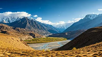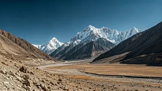


The Rain Shadow Advantage
Spiti's magic lies in its geography. Tucked behind the formidable Great Himalayan range, it sits in a rain shadow area. This means the towering peaks block most of the monsoon clouds, leaving the valley arid and sunny while the rest of the country deals
with downpours. While the approach roads, particularly from Manali, can be affected by rain, the valley itself remains largely accessible and dry, making it an ideal escape from July to September. This unique climate allows for clear skies, making it perfect for exploration when other mountain regions are impassable.
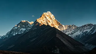
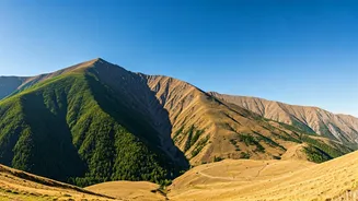
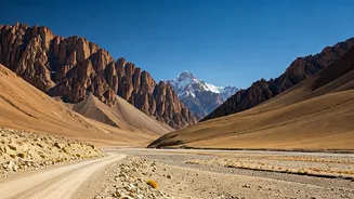
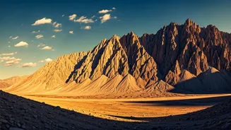
A Theatre of Stark Beauty
The "drama" of Spiti is etched into its very soul. It’s a world of stark, barren mountains painted in shades of brown, ochre, and grey. The landscape is punctuated by ancient, whitewashed monasteries that cling precariously to cliffsides. Key Monastery, the largest and oldest in Spiti, looks like a fortress of faith rising from a conical hill, offering panoramic views of the valley. Then there's Tabo Monastery, a UNESCO World Heritage site known as the 'Ajanta of the Himalayas' for its thousand-year-old murals preserved in mud-brick walls. And Dhankar, the former capital, is perched dramatically at the confluence of the Spiti and Pin rivers, with a serene lake a short trek above.
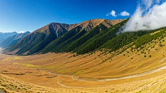
Iconic Villages and Celestial Lakes
The adventure continues in Spiti's high-altitude villages. Visit Hikkim, home to the world's highest post office, and send a postcard to loved ones. Explore Langza, the 'Fossil Village', where you can find ancient marine fossils, a reminder that these mighty mountains were once under the Tethys Sea. A colossal statue of the Buddha overlooks the valley here, creating a moment of serene grandeur. No trip is complete without a visit to Chandratal, the 'Moon Lake'. This crescent-shaped lake, with its crystal-clear blue water reflecting the surrounding peaks, is a breathtaking sight and a popular spot for camping under star-filled skies.
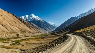
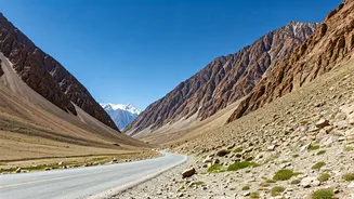
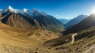
Choosing Your Path
There are two primary routes into Spiti, and your choice significantly impacts your journey. The route from Shimla via Kinnaur is longer (around 412 km to Kaza) but is generally considered safer and better for acclimatization. It offers a gradual ascent, allowing your body to adjust to the high altitude. The road from Manali is shorter (around 200 km to Kaza) but more challenging, crossing the high-altitude Kunzum Pass (4,551m) and the often-tricky Rohtang Pass or Atal Tunnel. While both routes are generally open by mid-June, the Manali road requires more caution due to rough patches and potential water crossings. For a first-timer, entering via Shimla and exiting via Manali is the most recommended circuit.
The Art of Acclimatisation
Spiti's high altitude (Kaza sits at around 3,800m or 12,500 ft) makes Acute Mountain Sickness (AMS) a real risk. Acclimatisation isn't optional; it's essential. The golden rule is to ascend slowly. Spend your first night or two at a lower altitude like Tabo or Kalpa before heading to Kaza. On your first day at a new height, take it easy. Avoid strenuous activity, walk slowly, and let your body adjust. Hydration is key; aim to drink 3-4 litres of water daily. Local foods like garlic soup and thukpa are light and aid acclimatization. Listen to your body and know the symptoms of AMS: headache, nausea, and dizziness.