


Understanding the Monsoon Risk
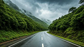
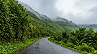
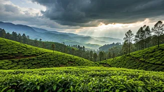
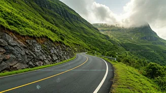
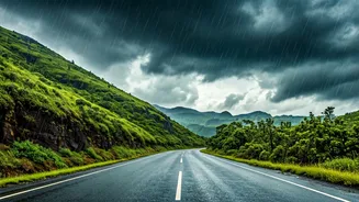
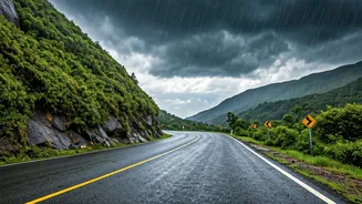
The magic of the monsoon in the Western Ghats is undeniable: misty hills, gushing waterfalls, and vibrant green landscapes. However, this season also brings significant dangers that every traveller must respect. Heavy, incessant rainfall can saturate
the soil on slopes, leading to sudden and catastrophic landslides that can block roads for hours or days. Rivers and streams can swell rapidly, causing flash floods that wash away bridges and inundate low-lying areas. Furthermore, thick fog and continuous downpours drastically reduce visibility on winding ghat roads, making driving treacherous. These aren't just possibilities; they are annual occurrences across states like Kerala, Karnataka, Maharashtra, and Goa. Acknowledging these risks is the first step in planning a journey that is both memorable and safe.
Your Primary Weather Toolkit: IMD
Your most reliable source for weather information is the India Meteorological Department (IMD). Before and during your trip, make its resources your first port of call. The official IMD website (mausam.imd.gov.in) provides district-level forecasts, colour-coded warnings (yellow, orange, red alerts), and doppler radar imagery to track rain intensity. For on-the-go updates, download the official 'Mausam' app. It offers current weather information, 7-day forecasts, and crucial warnings for your specific location. Pay close attention to the Nowcast feature, which gives alerts for severe weather events expected within the next three hours. These alerts are critical for making immediate decisions, such as delaying travel or finding a safe place to wait out a storm.
Navigating Road and Traffic Conditions
A clear weather forecast is useless if the road ahead is blocked. Unfortunately, a central, unified portal for all ghat road conditions doesn't exist. Your best bet is to piece together information from multiple sources. Start with the official Twitter (X) handles of state and district police departments. They often post real-time updates on road closures, diversions, and accidents. For example, the Kerala Police and Karnataka State Police traffic handles are highly active during the monsoon. Some National Highway Authority of India (NHAI) regional offices also provide updates. Before starting a leg of your journey, a quick search on social media for your route (e.g., "Shiradi Ghat traffic" or "Mumbai-Goa highway status") can reveal recent posts from officials and fellow travellers.
State-Specific Disaster Alerts
Each state has a State Disaster Management Authority (SDMA) responsible for issuing alerts and coordinating relief efforts. Their websites and social media channels are vital resources. The Kerala SDMA, for instance, is known for its proactive and clear communication on rainfall warnings, dam water levels, and landslide-prone areas. Similarly, the Karnataka State Natural Disaster Monitoring Centre (KSNDMC) provides detailed reports and advisories. Before entering a state, check its SDMA website for any specific warnings for the districts you plan to visit. Many also have dedicated emergency contact numbers. Save the SDMA helpline number for the state you're in on your phone.
Beyond Tech: The Power of Local Intel
Technology is a powerful tool, but it's not a substitute for on-the-ground intelligence. Local residents, taxi drivers, and hotel staff possess invaluable knowledge about the region's behaviour during the monsoon. They know which roads are the first to flood, which areas are prone to landslides, and which streams are deceptive. When you arrive in a town, strike up a conversation. Ask about the conditions on the road you plan to take. They can often provide insights that no app can. If a local advises against travelling a certain route, listen to them. This human network is your final, and often most important, safety check. Always build buffer time into your itinerary to accommodate unexpected delays and never, ever attempt to cross a flooded road or a stream in spate.