







The Chronic Challenge of Urban Flooding
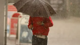
For residents of major Indian metropolitan areas like Mumbai, Chennai, and Bengaluru, waterlogging is a familiar and dreaded consequence of heavy rainfall. Drains overwhelmed by sudden downpours can quickly render roads, and especially underpasses, dangerously
flooded. This not only causes massive traffic gridlock and damages vehicles but also poses a significant risk to public safety. In the past, managing this has been a reactive process, with municipal authorities and traffic police scrambling to respond only after a road is already submerged. However, the rise of smart city initiatives is introducing a more proactive approach to flood management.
The Smart Solution: IoT Water Level Sensors
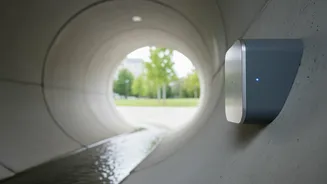
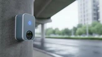
At the heart of this new approach are sophisticated drainage monitoring sensors. These are small, durable devices, often powered by solar energy, installed inside stormwater drains and at flood-prone locations like underpasses. Using various technologies—such as ultrasonic, radar, or pressure sensors—they perform one crucial function: measuring the real-time level of water within the drainage system. These sensors are the foundation of what is known as an Early Warning System (EWS) for urban floods. By constantly monitoring water levels, they can detect when a drain is nearing its capacity or when water is beginning to accumulate rapidly on a road.
How the Technology Works: From Sensor to Server
The process is a seamless flow of information enabled by the Internet of Things (IoT). First, the sensor measures the water level. This data is then transmitted wirelessly, typically using GSM cellular networks, to a central cloud server. Many systems have built-in redundancies, like dual SIMs, to ensure data transmission continues even if one network fails. Once the data reaches the server, it is processed by sophisticated models. These models might compare the incoming water level data against the known capacity of the drain and the area's topography to predict if flooding is imminent. The system can often issue colour-coded alerts—like yellow for caution and red for a severe flood warning—to municipal authorities.
From Data to Driver: Delivering the Warning
Collecting data is only half the battle; the crucial part is getting the warning to the people who need it most—the drivers. Once the system flags a potential or actual flood, alerts are disseminated through multiple channels. These can include direct SMS messages to civic agencies and traffic police, who can then barricade dangerous roads. For the public, these warnings can appear on dynamic message boards on major roads, as updates on official city apps, or integrated into popular navigation apps. The goal is to provide drivers with timely, actionable information that allows them to alter their route and avoid getting stranded.
Real-World Examples in Indian Cities
Several Indian cities have begun implementing these systems. Chennai launched a comprehensive, real-time flood forecasting system that aims to provide street-level inundation forecasts. This system integrates data from sensors in rivers, lakes, and stormwater drains. Similarly, Bengaluru has been working with the Karnataka State Natural Disaster Management Centre (KSNDMC) to deploy water level sensors in its stormwater drains since 2021 to provide alerts. Kolkata has also implemented a city-level flood forecasting system with real-time updates from sensor nodes. These initiatives represent a significant step up from manual monitoring or simple painted level-markers, which, while helpful, are not as dynamic.
Challenges and the Road Ahead
The implementation of this technology is not without its hurdles. A 2025 report by the Comptroller and Auditor General (CAG) on a Bengaluru project noted issues like non-functional or stolen sensors, which can compromise the entire warning system's effectiveness. Ensuring the sensors are maintained, protected from vandalism, and remain functional during extreme weather is a continuous challenge. Furthermore, the accuracy of flood prediction depends heavily on the quality of the hydrological models and the comprehensive mapping of the city's drainage network. Despite these challenges, the technology holds immense promise. As systems become more robust and integrated with advanced weather forecasting, they can evolve from being merely rescue tools to proactive flood prevention aids.