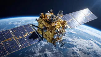




In an age where a tap on a smartphone connects us to the world, India has been steadily building its own answer to GPS. The recent launch of the NVS-03 satellite marks a critical step in bolstering this indigenous navigation system, NavIC.
What is NavIC?
NavIC, which
stands for Navigation with Indian Constellation, is India's autonomous regional satellite navigation system, developed by the Indian Space Research Organisation (ISRO). Think of it as India’s homegrown version of the American Global Positioning System (GPS). Unlike global systems like GPS, Russia's GLONASS, or Europe's Galileo, NavIC is designed specifically to serve India and a region extending about 1,500 kilometres beyond its borders. This regional focus allows it to provide highly accurate and reliable positioning data, with a stated accuracy of better than 20 meters. The need for an independent system was highlighted during past geopolitical events, reinforcing the strategic importance of self-reliance in navigation for both civilian and military purposes. NavIC provides two types of services: a Standard Positioning Service (SPS) for all users and an encrypted Restricted Service (RS) for authorized users, such as the military.
A Second-Generation Upgrade
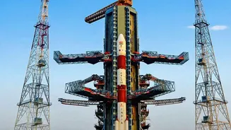
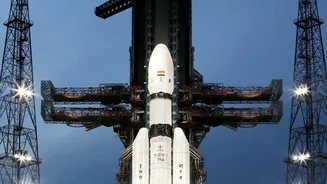
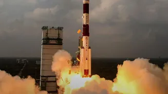
The NVS-03 is the third satellite in ISRO's second-generation NVS series, designed to augment and modernise the original constellation of satellites. This new generation of satellites was needed to ensure the continuity of NavIC services, which had faced challenges due to the failure of imported atomic clocks on some of the older satellites. With a planned mission life of 12 years, the NVS satellites are built for longevity, surpassing the 10-year lifespan of their predecessors. The successful launch of NVS-03 aboard the GSLV-F18 rocket on October 30, 2026, was a significant milestone, restoring the NavIC constellation to its minimum operational strength of four satellites.
The Crucial New Features of NVS-03
What makes the NVS-03 launch so crucial are its technological upgrades. Foremost among them is the inclusion of an indigenously developed Rubidium atomic clock. Atomic clocks are the heart of any navigation satellite, providing the ultra-precise timekeeping needed to calculate a receiver's position accurately. Developing this technology inhouse is a major leap towards complete self-reliance, reducing dependence on foreign suppliers. Another key feature is the addition of the L1 frequency band, which is the most widely used frequency for civilian GPS and navigation services globally. By broadcasting on the L1 band, alongside the existing L5 and S bands, NavIC becomes more interoperable and easier for consumer devices like smartphones and wearables to adopt without needing major hardware changes.
Beyond Maps: NavIC's Real_World Impact
While we often associate navigation with finding our way on roads, NavIC's applications are far broader and more strategic. For the military, it provides a secure, encrypted service for guiding precision munitions and coordinating operations in GPSdenied environments. In the civilian sphere, its impact is just as profound. It's crucial for disaster management, helping to locate affected areas and guide rescue teams with precision. The transport and logistics sector benefits from improved vehicle tracking and fleet management. Furthermore, NavIC is already being used to track thousands of railway locomotives and fishing vessels, enhancing safety and operational efficiency. Its precise timing signals are also vital for synchronising power grids, banking networks, and telecommunication systems.
The Road Ahead for India's Own GPS
The successful integration of NVS_03 into the NavIC constellation is more than just a technical achievement; it's a statement of India's growing capabilities in space technology and its commitment to strategic autonomy. The launch reinforces the 'One Nation, One Time' vision, aiming to establish Indian Standard Time as the legally recognised time reference across the country, powered by its own sovereign system. With NVS_03 restoring the system's operational strength, ISRO is already looking ahead, with plans for NVS_04 and NVS_05 in the pipeline to further strengthen the constellation. As more secondgeneration satellites join the network, NavIC is poised for wider adoption, not just in strategic sectors but in the everyday devices and services used by millions of Indians, solidifying its place as a cornerstone of the nation's digital infrastructure.