





A Living, Breathing Shield
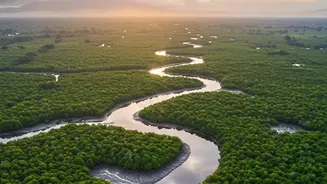
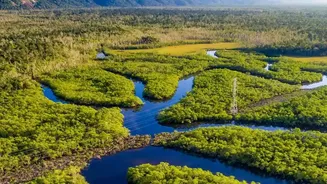
The Sundarbans, a sprawling forest that straddles the delta of India and Bangladesh, is more than just a UNESCO World Heritage site; it is a dynamic, living fortress. For centuries, coastal communities have known that the dense network of mangrove trees
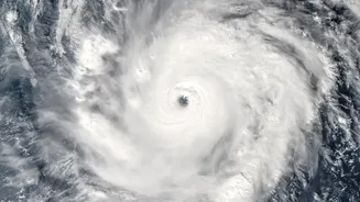
protects them from the full fury of cyclones barreling in from the Bay of Bengal. This forest acts as a natural buffer, its intricate root systems anchoring the coastline, while its dense canopy and trunks absorb and dissipate the destructive energy of storm surges and waves. During powerful cyclones like Amphan and Yaas, anecdotal evidence has consistently shown that villages shielded by healthy mangroves suffer significantly less damage from flooding and erosion. This vast ecosystem is not merely a collection of trees but a critical piece of natural infrastructure safeguarding millions of lives and livelihoods.
The Science of a Natural Breakwater
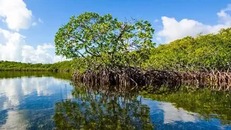
The protective power of mangroves is rooted in solid science. As a storm surge—a wall of water pushed inland by a cyclone—hits the forest, it encounters immense friction. The complex structure of mangrove roots, trunks, and branches acts like a massive sponge, slowing the water's velocity and reducing its height. Scientific studies have quantified this effect, showing that mangroves can reduce storm surge water levels by 5 to 50 centimetres for every kilometre of forest width. Their dense root systems also trap sediment, which not only prevents coastal erosion but actively builds up the land over time, helping to counteract rising sea levels. This ability to bind the soil and break the power of waves makes mangroves a far more resilient and self-repairing coastal defence than any concrete wall.
The Unblinking Eye in the Sky
For years, the sheer scale and inaccessibility of the Sundarbans made comprehensive monitoring difficult. This is where satellite imaging has become a game-changer. Using data from satellites like the Copernicus Sentinels and Landsat, scientists can now track the health, density, and extent of the entire mangrove ecosystem in near real-time. Technologies such as Normalised Difference Vegetation Index (NDVI) use light reflectance to measure the health and greenness of the canopy, revealing areas under stress from climate change, rising salinity, or human activity. Radar satellites can penetrate cloud cover, providing invaluable data during and immediately after a cyclone, allowing for rapid damage assessment that was previously impossible. This continuous stream of information allows us to see the forest not as a static green patch on a map, but as a living, changing system.
From Pixels to Accurate Predictions
The true breakthrough lies in feeding this satellite data into coastal defense and flood risk models. Historically, these models often treated coastal vegetation as a simple, uniform feature, or ignored it altogether. This led to significant underestimations of the protective role played by mangroves. By incorporating high-resolution data on mangrove density, width, and health, today's models can more accurately simulate how a storm surge will behave as it moves inland. Advanced models can now create 'with' and 'without' mangrove scenarios, demonstrating precisely how much worse flooding would be if the forest were not there. Studies in other regions have shown mangroves can reduce property damage from major hurricanes by as much as 30%, saving billions of dollars. This data-driven approach transforms our understanding, turning the forest's protective service into a quantifiable value that policymakers can't ignore.
A Crucial Tool for an Uncertain Future
This fusion of satellite technology and ecological science is crucial for India's coastal resilience strategy. More accurate flood models enable better land-use planning, ensuring new infrastructure is not built in high-risk zones. They allow for more effective disaster management, helping authorities issue precise evacuation warnings and pre-position resources. Furthermore, the clear, quantifiable evidence of the mangroves' value provides a powerful argument for their conservation and restoration. As climate change promises more frequent and intense cyclones, the satellite data confirms a vital truth: protecting and restoring the Sundarbans is not just an environmental issue, but a fundamental pillar of national security and economic stability. The view from space makes it clear that this natural shield is our most important ally in the fight against a rising tide.