






A New Generation of Weather Watchers
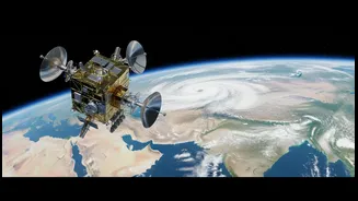
High above the Earth, a family of advanced meteorological satellites operated by the Indian Space Research Organisation (ISRO) is keeping a constant watch over the subcontinent. The INSAT series, particularly INSAT-3D, INSAT-3DR, and the recently launched
INSAT-3DS, are game-changers for weather forecasting in India. Positioned in geostationary orbit, they provide a continuous stream of data, offering a persistent eye on a region that is notoriously difficult to forecast. These aren't just cameras taking simple pictures of clouds; they are sophisticated multi-tool instruments designed to capture the full, complex story of the atmosphere.
More Than Just a Cloud Map
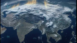
The "clearer visual context" comes from the advanced instruments these satellites carry. The Imager can see the Earth in multiple spectral channels, not just visible light. This allows it to distinguish between snow and clouds, detect fog at night, and even identify aerosols like dust and smoke. Working in tandem, INSAT-3D and INSAT-3DR can capture an image of the Indian region as frequently as every 15 minutes. But perhaps the most powerful tool is the Sounder, which provides vertical profiles of the atmosphere, measuring temperature, humidity, and water vapour at different altitudes. This gives meteorologists a three-dimensional understanding of the atmospheric conditions that fuel the monsoon.
Powering Precision Forecasts
This wealth of data flows directly to the India Meteorological Department (IMD), where it forms the backbone of modern weather prediction. In fact, over 90% of the data used in India's numerical weather models is now satellite-based. This has significantly improved the accuracy of forecasts, particularly for severe weather events. Parameters like cloud top temperature, wind fields, and Outgoing Longwave Radiation (OLR) are critical inputs that help the IMD declare the monsoon's onset and track its progression across the country. This enhanced capability allows for more timely and accurate warnings for cyclones, thunderstorms, and heavy rainfall, giving authorities and the public crucial time to prepare.
From Data to Daily Decisions
The impact of this technology extends far beyond the weather office. For India's vast agricultural sector, which is heavily dependent on the monsoon, better forecasts mean better decisions. Farmers can more effectively plan for sowing and irrigation, mitigating risks associated with erratic rainfall. For disaster management agencies, the ability to anticipate flash floods or cyclones with greater precision is invaluable for planning evacuations and deploying resources. The data also supports long-term climate adaptation strategies by monitoring coastal changes, glacier melt, and heatwave patterns. Even on a daily basis, these satellite insights help inform everything from aviation to urban planning.
Changing the Monsoon Narrative
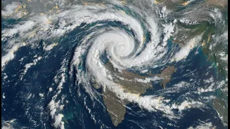
Ultimately, the clearer view from ISRO's satellites is changing how we talk about the monsoon. The vivid, near-real-time imagery and multi-layered data help transform abstract meteorological concepts into a tangible, unfolding story. It allows forecasters, journalists, and officials to communicate the dynamics of the monsoon with greater clarity and urgency. Instead of just reporting on rain, they can now visually explain the atmospheric rivers, convective systems, and moisture-laden winds that define the season. This deeper understanding fosters greater public awareness and resilience, equipping an entire nation to better navigate the complexities of its most vital weather phenomenon.