





A Groundbreaking Partnership
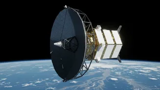
The NASA-ISRO Synthetic Aperture Radar (NISAR) mission is a joint project between the US and Indian space agencies, representing one of the significant collaborations in Earth observation. Launched in 2025, this advanced satellite is the first to use
two different radar frequencies simultaneously to scan our planet, offering a uniquely detailed and comprehensive view of its surface. Orbiting Earth every 12 days, NISAR provides a consistent and reliable stream of data, day or night, regardless of weather conditions. Recently, ISRO began releasing processed data from its S-band radar to the public through its Bhoonidhi portal, following NASA's release of L-band data, empowering researchers and disaster management agencies with unprecedented information.
The Power to See Through Storms
What makes NISAR a game-changer for flood monitoring is its use of Synthetic Aperture Radar (SAR), which can penetrate clouds, darkness, and even dense forest canopies. This is crucial in a place like India, where monsoon floods are often obscured by thick cloud cover, rendering traditional optical satellites ineffective. The satellite carries two types of radar: NASA's L-band and ISRO's S-band. The L-band, with its longer wavelength, is excellent at penetrating vegetation to see the ground and water beneath. This means it can detect flooding in forests and agricultural areas, which was previously very difficult to map accurately. The S-band complements this by providing high-resolution data on soil moisture and other surface characteristics. Together, they create a complete picture of where water is, even when it's hidden.
From Data to Life-Saving Maps
The raw data from NISAR is powerful, but its true value lies in how it's translated into actionable information. By comparing images taken over the same area at different times, scientists can detect tiny changes in water levels, down to a centimetre. This allows them to create highly detailed and timely flood inundation maps. These maps can show not only which areas are flooded but also the depth of the water in vegetated regions, serving as a 'virtual stream gauge'. For disaster response teams, this is invaluable. Data is expected to be available within hours of an observation during emergencies, enabling authorities to understand the extent of a disaster, identify the hardest-hit communities, and strategically deploy resources for rescue and relief operations.
Improving Forecasts and Managing Risk
Beyond immediate disaster response, NISAR's consistent data collection is transforming how flood hazards are understood and predicted. By monitoring changes in soil moisture, river levels, and ground saturation over time, scientists can build more accurate flood forecast models. Knowing how wet the ground is before a major rainfall event helps hydrologists predict the potential for runoff and flash floods. Furthermore, the satellite can detect slow-moving changes to the land surface, such as ground subsidence from groundwater extraction or shifts in levees and dams, which can exacerbate flood risk. This long-term monitoring allows for better urban planning, infrastructure maintenance, and the development of more resilient communities in flood-prone zones.
More Than Just Floods
While its impact on flood management is profound, NISAR's capabilities extend to a wide range of critical environmental insights. The mission provides vital data for monitoring agricultural health, including crop growth and irrigation patterns. It tracks the retreat of glaciers and ice sheets, offering a clearer picture of climate change impacts. Scientists also use its data to study landslides, volcanic activity, and deforestation. By providing a comprehensive, all-weather look at Earth’s dynamic systems, NISAR helps create a holistic understanding of our planet's health and the interconnectedness of its various processes.