








The El Niño Effect
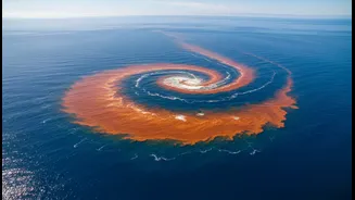
First, let's recap the main character. El Niño is a climate pattern defined by the unusual warming of surface waters in the central and eastern equatorial Pacific Ocean. This vast pool of warm water shifts weather patterns globally. For India, it typically
disrupts the atmospheric circulation that fuels the southwest monsoon. The powerful trade winds that push moisture towards Asia weaken, leading to suppressed rainfall and, in many historical cases, drought-like conditions. Forecasts for 2026 indicate a strengthening El Niño, which has already been linked to a rainfall deficit in the early part of the season. This naturally raises concerns for agriculture, water reservoirs, and the broader economy, all of which are deeply intertwined with the monsoon's performance.
The Indian Ocean's Counterpart
Fortunately, the Pacific isn't the only ocean with a say. The Indian Ocean has its own climate phenomenon, known as the Indian Ocean Dipole (IOD). Often called the 'Indian El Niño,' the IOD is about the temperature difference between the western Indian Ocean (near Africa) and the eastern Indian Ocean (near Indonesia). The IOD has three phases: positive, negative, and neutral. In a 'positive' IOD phase, the western Indian Ocean becomes warmer than the east. This change can create a powerful counter-mechanism to El Niño. The warmer water in the Arabian Sea boosts evaporation and strengthens winds blowing towards India, enhancing moisture supply and potentially leading to better rainfall, especially in the latter half of the monsoon season. Historically, strong positive IODs have helped offset the drying effects of El Niño, as seen in years like 1997.
The Tropical Wave
Another crucial, though more short-term, factor is the Madden-Julian Oscillation (MJO). The MJO is a large, eastward-moving pulse of clouds, rainfall, and wind that travels around the tropics every 30 to 60 days. Think of it as a massive tropical wave that can either enhance or suppress rainfall depending on its location. When the active phase of the MJO is over the Indian Ocean, it can boost convection and lead to a burst of monsoon rain. Conversely, when its suppressed phase is active, it can cause a 'break' in the monsoon. The MJO's interaction with El Niño is complex; El Niño can influence the MJO's behaviour, and in turn, the MJO's position can either amplify or dampen El Niño's impact on India's rainfall during a given week or month.
A Delicate Climatic Balance
The fate of India's monsoon is rarely decided by a single factor. It's the result of a delicate and often unpredictable interplay between these major climatic drivers. A strong El Niño is a powerful force that tends to weaken the monsoon. However, a concurrent positive IOD can act as a significant counterbalance, pushing moisture back towards the subcontinent. Meanwhile, the MJO adds another layer of variability, capable of delivering much-needed rain during a dry spell or temporarily worsening conditions. While some forecasts for 2026 suggest the IOD may turn positive later in the season, its strength and timing will be critical in determining how effectively it can counteract the strong El Niño that is forecast to persist. This complex interaction is why forecasting the monsoon is so challenging and why early-season deficits don't always tell the whole story. As climate change continues to warm the oceans, it may also be altering how these patterns interact, adding another layer of uncertainty.