
An Event That Shook the Earth
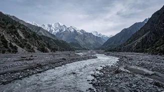
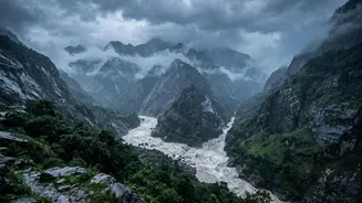
In June 2021, a devastating flood and debris flow surged down Nepal's Melamchi River valley, causing immense destruction to homes and infrastructure, including the headworks of a vital water supply project for Kathmandu. Initially, the ground vibrations
picked up by monitoring stations led to confusion, with some speculating that an earthquake had triggered a landslide or a Glacial Lake Outburst Flood (GLOF). However, further analysis by geologists and seismologists revealed a startling truth: there was no earthquake. The seismic signal itself was generated by the sheer force of the flood—a torrent of water, sediment, and boulders crashing its way down the valley. This phenomenon, where a river event is powerful enough to be recorded as a seismic wave, has opened up a fascinating field of study known as fluvial seismology.
How Can Water Shake the Ground?
It seems counterintuitive that flowing water could mimic an earthquake, but the physics behind it is a matter of immense force and friction. A normal river flows relatively smoothly, but a catastrophic flood or a debris flow is a different beast entirely. These events transport enormous quantities of sediment, from fine sand to massive boulders. As this chaotic mixture surges downstream, the constant collision of these boulders with each other and with the riverbed generates intense, low-frequency vibrations. The turbulence of the water itself also transfers energy into the ground. When you have millions of tons of water and rock moving at speed through a confined valley, the ground literally trembles under the strain, and this trembling is what seismometers are designed to detect.
Decoding a Flood's Seismic Fingerprint
While both earthquakes and massive floods can make the ground shake, their seismic signatures are distinctly different. An earthquake is caused by a sudden slip along a fault, releasing energy in sharp, intense waves that typically last for seconds or minutes. In contrast, the seismic signal from a flood is more of a continuous, long-duration rumble. Scientists can analyze the frequency of the waves to distinguish between the two. Earthquake signals often have a broader range of frequencies, while floods and debris flows tend to produce a more sustained, low-frequency noise. By studying these patterns, researchers can not only identify a flood but also estimate its velocity, the volume of debris it carries, and its path as it moves downstream.
A New Tool for Early Warning Systems
The discovery that floods have a detectable seismic footprint has profound implications for disaster management, particularly in mountainous regions like the Himalayas. Traditional flood warnings rely on river gauges, but these can be easily damaged or destroyed by the very floods they are meant to monitor. Seismometers, however, can be placed at a safe distance from the river itself and still pick up the crucial signals. This offers the potential for a robust early warning system. By setting up networks of seismometers in vulnerable catchments, authorities could detect a dangerous debris flow or flash flood the moment it starts, providing precious minutes or even hours of warning to downstream communities. This time could be enough to evacuate people and save lives, turning a scientific curiosity into a practical life-saving tool.
Relevance in a Changing Climate
This emerging science is especially critical in the context of climate change. As global temperatures rise, glaciers in the Himalayas are melting at an accelerated rate, increasing the instability of mountain slopes and the risk of events like the Melamchi flood. The 2015 Gorkha earthquake also left many slopes in the region more vulnerable to landslides. Understanding and monitoring these cascading hazards—where one event triggers another—is a major priority. Fluvial seismology provides a new lens through which to watch over these remote and dangerous landscapes. By listening to the rumbles of the rivers, scientists hope to better anticipate the growing threats and build more resilient communities in the shadow of the world's highest mountains.