




A New Eye in the Sky
For decades, we have relied on a combination of ground-based river gauges and weather forecasts to predict floods. While useful, this approach has limitations, especially in remote areas or when infrastructure is damaged during a disaster. Today, Earth
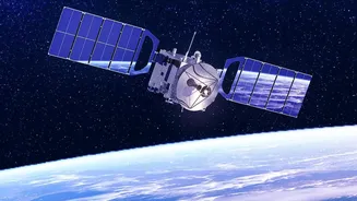
Observation (EO) provides a revolutionary advantage. This involves using data from satellites to monitor our planet. These aren't just simple cameras; advanced sensors can measure changes on the Earth's surface with incredible precision, offering a comprehensive view that ground-level tools cannot match. This constant stream of information from space is changing how we prepare for and react to natural calamities.
Seeing Water Like Never Before
Modern satellites are equipped with sophisticated instruments that see far more than the human eye. Synthetic Aperture Radar (SAR) is a key technology, as it can penetrate clouds and operate day or night, which is crucial during severe weather events that often bring floods. Missions like the NASA-led Surface Water and Ocean Topography (SWOT) satellite use radar interferometry to measure the height of water in rivers, lakes, and reservoirs with centimetre-level accuracy. It can also measure the width and slope of rivers, providing a 3D view of how water is moving across the landscape. This gives hydrologists a near-complete picture of water volume and flow, something that was previously impossible on a global scale.
From Data to Actionable Warnings
Collecting data is only the first step. The real magic happens when this information is fed into advanced computer models. These models simulate how water will travel through a river system. By continuously updating these models with near-real-time satellite data on soil moisture, water levels, and rainfall, forecasters can significantly improve their predictions. The integration of Artificial Intelligence (AI) and machine learning further enhances this process. AI algorithms can sift through massive datasets to identify complex patterns and correct errors, making flood maps more accurate and increasing the lead time for warnings. This means authorities have more time to issue evacuation orders and position emergency resources where they are needed most.
The Indian Context: A Game-Changer
For a country as vast and geographically diverse as India, which faces annual monsoon floods, this technology is transformative. The Indian Space Research Organisation (ISRO) has long used its satellite constellations, like the INSAT and Resourcesat series, for disaster management. A particularly exciting development is the upcoming NASA-ISRO Synthetic Aperture Radar (NISAR) mission. This joint project will provide exceptionally detailed data on everything from agricultural lands to Himalayan glaciers, which is vital for predicting glacial lake outburst floods (GLOFs). NISAR’s all-weather, day-and-night imaging capabilities will be instrumental in monitoring India's major river basins, like the Brahmaputra and Godavari, providing critical inputs for early warning systems. Researchers at institutions like IITB-Monash Research Academy are already developing flood-mapping tools that use satellite data to account for India's varied terrain, promising more precise, localised warnings.
Beyond Prediction: Building Long-Term Resilience
The benefits of improved EO data extend beyond immediate disaster response. Over time, the historical archive of satellite imagery helps planners and policymakers understand flood patterns with unprecedented clarity. ISRO has already used decades of data to create a Flood Affected Area Atlas for India, which helps identify long-term flood-prone zones. This information is invaluable for making smarter decisions about land use, such as where to build new infrastructure like roads, hospitals, and residential areas. By understanding which areas are repeatedly inundated, governments can better invest in flood mitigation measures, like embankments and improved drainage, and develop more robust building codes. This shifts the focus from simply reacting to disasters to proactively building resilient communities.