







The Limits of Traditional Forecasting
For decades, weather prediction has relied on a combination of ground-based weather stations, balloons, and radar systems. While these tools are excellent for forecasting large-scale weather patterns over several days, they have significant limitations.
Ground-based radar, for instance, sends out beams that travel in a straight line. Due to the Earth's curvature, these beams fly higher and higher above the ground as they move away from the radar station. This means that for areas far from a radar site, the system can only see the middle and upper parts of a storm, potentially missing the crucial low-level activity that leads to intense surface rainfall. Furthermore, radar signals can be blocked by terrain like mountains or weakened by heavy precipitation, leading to an underestimation of a storm's intensity. These gaps in coverage and detail are why a forecast might predict 'scattered showers' for a state, but cannot tell you if a specific neighbourhood is about to get two inches of rain in one hour.
A New Eye in the Sky: Atmospheric Profiling
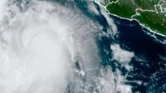
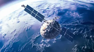
Enter satellite atmospheric profiling. This technology represents a fundamental shift from looking at a storm to looking inside it from space. Instead of just tracking cloud cover, specialised instruments on satellites, known as microwave sounders, can penetrate clouds to measure the vertical profile of the atmosphere. They do this by detecting the faint microwave energy naturally emitted by the Earth and its atmosphere. Different frequencies of this energy correspond to different altitudes and reveal crucial details about temperature, water vapour content, and the presence of ice and water droplets within a storm system. This creates a three-dimensional picture of the atmospheric column, from top to bottom.
Seeing the Rain Before It Falls
The key advantage of this technology, particularly with newer constellations of small satellites, is the ability to gather this 3D data with unprecedented frequency. While large, traditional weather satellites might view a location once or twice a day, a network of smaller 'CubeSats' can pass over the same area almost hourly. This high-frequency data allows meteorologists to see the inner workings of a storm as it develops. They can identify the rapid vertical movement of moisture and the build-up of precipitation high in the atmosphere—the tell-tale signs of an imminent, intense downpour. Instruments like the Advanced Technology Microwave Sounder (ATMS) provide this all-weather data, allowing forecasters to see inside storms and improve prediction models significantly. This is the difference between knowing a storm exists and knowing how and when it will unleash its full force on a specific area.
From Hyperlocal Forecast to Urban Action
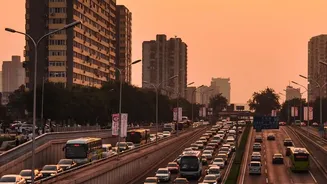
This precise, hyperlocal forecasting is a game-changer for urban management. Armed with a one- to three-hour warning of an impending deluge in a specific part of the city, municipal authorities can move from reactive clean-up to proactive prevention. Emergency services can be placed on standby in flood-prone areas. Traffic can be preemptively rerouted away from low-lying roads and underpasses that are known to flood. Public transport schedules can be adjusted, and alerts can be sent directly to citizens' phones, advising them to avoid certain areas or delay travel. For critical infrastructure, utility companies can prepare for potential power outages, and facilities managers can take steps to protect buildings and equipment. Recent studies focusing on Indian cities like Mumbai have demonstrated how integrating satellite data with machine learning can produce granular, ward-level flood predictions, turning this technology into a powerful decision-support tool.