






Near Real-Time Disaster Management
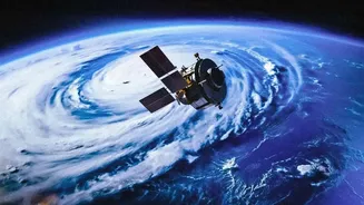
One of the most significant advantages of GISAT-1A is its geostationary orbit, which allows it to watch over the Indian subcontinent continuously. Unlike polar-orbiting satellites that revisit a location periodically, GISAT-1A can provide a constant stream
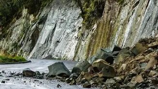
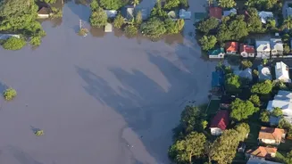
of images. This capability is a game-changer for disaster management. During rapidly evolving events like cyclones, floods, and forest fires, authorities can receive updates at frequent intervals, with the ability to capture an image of a selected area every five minutes. This near real-time information allows for quicker and more accurate tracking of a cyclone's path, assessing the scale of flooding, and identifying forest fire hotspots. The result is more effective planning for evacuations, better coordination of emergency response teams on the ground, and ultimately, the potential to save more lives.
A Boost for Agricultural Planning
India's agricultural sector, the backbone of its economy, stands to gain immensely from GISAT-1A's capabilities. The satellite's multi-spectral imaging can monitor crop health over vast areas, helping to detect stress from lack of water or pest attacks early on. This data is crucial for forecasting crop yields, assessing drought conditions, and managing water resources more efficiently. Government agencies can use these insights to formulate better agricultural policies, manage food security, and plan for contingencies. By providing detailed, regular updates on land use and crop patterns, the satellite will become an invaluable tool for both farmers and policymakers, contributing to a more resilient and productive agricultural ecosystem.
Strengthening National Security
While primarily a civilian satellite, GISAT-1A's persistent gaze has powerful strategic implications. The ability to frequently monitor areas of interest along India’s vast land borders and extensive coastline provides a significant boost to national security. The satellite can be tasked to keep a close watch on sensitive regions, detecting changes in infrastructure or movements that might require attention from security forces. This continuous monitoring capability complements other surveillance assets, providing a wide-area view that helps in maintaining situational awareness. While not providing the high resolution of dedicated military spy satellites, its ability to offer rapid revisits of large areas adds a crucial layer to India's defence and surveillance framework.
Smarter Urban and Infrastructure Planning
As India continues to urbanise at a rapid pace, managing the growth of cities and planning for infrastructure becomes increasingly complex. GISAT-1A can provide invaluable data for urban planners by monitoring urban sprawl, tracking the progress of major infrastructure projects, and assessing environmental changes in and around cities. The satellite's imagery can help in managing natural resources like water bodies and green cover within urban landscapes. This information is vital for sustainable development, ensuring that expansion is well-planned and its environmental impact is minimized. From monitoring deforestation to managing water levels in reservoirs, GISAT-1A will provide the macro-level data needed for smart and sustainable resource management across the country.
Advancing Weather and Climate Studies
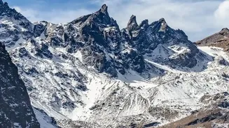
GISAT-1A is also set to enhance India's capabilities in meteorology and climate science. The satellite can provide regular updates on cloud cover, ocean data, and snow and glacier conditions. This stream of data will help meteorologists generate more accurate short-term weather forecasts and warnings. For a country heavily dependent on the monsoon, better weather prediction has far-reaching benefits for agriculture, water management, and public safety. Furthermore, by monitoring glaciers and snow cover over the long term, the satellite will contribute valuable data to climate change studies, helping scientists understand the impact on India's vital water resources originating in the Himalayas.