







A New Perspective on Water
For decades, monitoring water quality has been a painstaking, ground-based effort. It involved sending teams to collect physical samples from various points in a river or lake, followed by lengthy lab analysis. While essential, this method is slow, expensive,
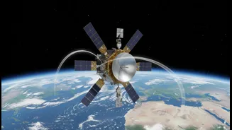
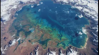
and can only ever cover a tiny fraction of our water bodies at any given time. This is where Earth Observation (EO) satellites come in, offering a powerful, bird's-eye view. These satellites are equipped with sophisticated sensors that can 'see' what's in the water without ever touching it. By analysing the colour of the water, these instruments can tell us a great deal. For example, bright green swirls can indicate a dense bloom of algae, while brown, murky plumes often signal high levels of sediment runoff from land.
Spotting Pollution from Orbit
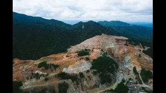
One of the most powerful applications of this technology is in detecting harmful algal blooms (HABs). These blooms, often fuelled by nutrient pollution from agricultural runoff and sewage, can produce toxins that are dangerous to humans and wildlife. Satellites can detect the unique signature of chlorophyll, the pigment in algae, allowing authorities to spot the formation of a bloom early. This provides a critical window to issue public health warnings and investigate the source of the pollution. Similarly, satellites are exceptionally good at tracking sediment plumes. After heavy rainfall, vast amounts of soil can be washed into rivers and carried out to sea. Satellite imagery can show the extent of these plumes, helping scientists understand the impact of land use on coastal ecosystems and pinpoint areas suffering from severe erosion.
From Data to Dialogue
Perhaps the most significant impact of satellite data is how it transforms the conversation around water quality. This technology moves the issue from anecdotal reports to objective, large-scale evidence. When a community group complains about pollution, satellite imagery can provide clear, visual proof that is difficult for polluters or authorities to ignore. This data serves as a common, factual basis for discussion among scientists, policymakers, and the public. It allows for the tracking of pollution over time, helps to identify specific sources like industrial discharge points or overflowing sewage systems, and enables an assessment of whether environmental policies are actually working. It democratises information, empowering local groups with the evidence they need to advocate for cleaner water in their communities.
The View from India
In India, space technology is already playing a crucial role in water management. The Indian Space Research Organisation (ISRO) actively uses its satellite constellations for water resource assessment, from monitoring surface water bodies to mapping groundwater prospects. The National Mission for Clean Ganga, for instance, leverages geo-spatial and remote-sensing technology to better plan and monitor its projects along the river. The innovation extends to the private sector as well. Aumsat, an Indian startup born out of experience with the Chandrayaan-2 lunar mission, uses satellite-based radar to locate underground water sources and detect leaks in pipelines. Another company, Pixxel, is building a constellation of hyperspectral imaging satellites that will provide incredibly detailed data on water pollutants, agricultural health, and more, offering an even clearer picture of our environment.
Challenges and Collaboration
Of course, this technology is not a silver bullet. Satellites cannot see through clouds, which can be a significant limitation during monsoon season. Furthermore, the data they collect are proxies—they can detect the presence of algae but cannot directly measure the specific toxins it might be producing. That's why this approach is most powerful when combined with traditional methods. The satellite data can guide on-the-ground teams, telling them exactly where to go to collect samples for detailed analysis. This combination of broad, consistent satellite monitoring with targeted, precise field sampling creates a highly efficient and effective system for managing water quality.