




Why This Checklist Matters Now
Bengaluru's rapid urban expansion has come at a cost. The city, which sits on a ridge draining into three primary valleys, has seen its natural water pathways, or rajakaluves, heavily encroached upon and built over. This, combined with increasingly intense
pre-monsoon and monsoon showers, has led to predictable yet devastating flooding in recent years. Areas like Mahadevapura, Bellandur, Sarjapur Road, and HSR Layout have become synonymous with waterlogging, where even a short downpour can turn roads into rivers and flood basement parking and ground-floor homes. This isn't just an inconvenience; it represents a significant financial and emotional risk for homeowners. A data-driven checklist is no longer a 'nice-to-have' but an essential part of property due diligence in the city.
Step 1: Decode the Drain Maps
The foundation of any flood-risk assessment is understanding the city's network of Stormwater Drains (SWDs), or rajakaluves. The Bruhat Bengaluru Mahanagara Palike (BBMP) maintains maps of primary, secondary, and tertiary drains. More importantly, the civic body periodically identifies a list of vulnerable drains prone to overflowing. As of early 2026, reports indicated over 200 such vulnerable SWDs across the city, with a high concentration in the Mahadevapura zone. When evaluating a property, the first step is to check if it falls near one of these critical drains. It's not just about whether the property sits directly on a drain, but also if it is within the legally mandated buffer zone, an area where construction is restricted to allow for water flow and maintenance. Citizen-led initiatives and research portals have also made this data more accessible by overlaying these drain maps onto familiar platforms like Google Maps.
Step 2: Investigate Site Elevation
A property might be clear of any drains but can still be at high risk if it's in a low-lying area. Bengaluru's topography is characterized by a series of interconnected valleys; water will always find its natural, lowest path. A home built in a local depression or at the bottom of a slope can become a collection point for runoff from the entire neighbourhood. Therefore, checking the site's elevation is critical. This isn't just about the city's overall high altitude of around 900 metres, but the specific elevation of the plot relative to its immediate surroundings, nearby lakes, and the general gradient of the land. Various online tools and topographic maps can provide a good estimate of a property's elevation, allowing you to compare it with the surrounding terrain and identify potential risks that a simple site visit on a sunny day might miss.
Step 3: Uncover the Waterlogging History
Maps and data provide a crucial part of the story, but a location's history is just as important. Before finalising a decision, become a local historian for your chosen neighbourhood. Scour online news archives and social media for mentions of your specific area or layout during past monsoon seasons. Local news outlets and citizen reporting platforms often provide detailed accounts of which streets and apartment complexes were affected during heavy rainfall events. This provides real-world evidence that can validate or contradict the data from drain and elevation maps. Furthermore, nothing beats on-the-ground intelligence. Speak to shopkeepers, security guards, and longtime residents in the area. Ask them directly about waterlogging on the approach roads and within the property. Their lived experience is an invaluable and often brutally honest source of information.
Step 4: Conduct a Thorough On-Ground Inspection
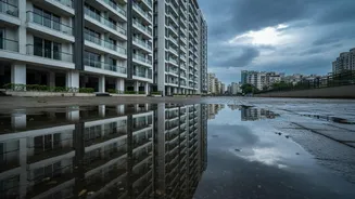
Finally, synthesize all your research with a physical inspection, ideally during or immediately after a spell of rain. Look for tell-tale signs that maps alone won't show. Are the roads leading to the property prone to waterlogging? Check the basement of the apartment building for water marks, signs of dampness, or recently painted walls that might conceal past damage. Examine the ground floor and common areas for any evidence of flooding. Pay attention to the property's drainage system. Does it seem well-maintained? Are there open drains nearby that are filled with garbage or silt? For individual houses or plots, observe the natural flow of water. Is the plot visibly lower than its neighbours? This final, practical check connects your research to the physical reality of the property, giving you the most complete picture of the risk involved.