






1. Revolutionising Agriculture
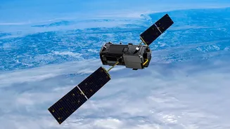
For the millions involved in Indian agriculture, timely and accurate information is gold. Earth observation satellites provide exactly that. Satellites like ISRO’s EOS-04 (also known as RISAT-1A) use radar to see through clouds, monitoring crop health,
soil moisture, and acreage across vast farmlands. This data, accessible through government portals like Bhuvan, helps forecast yields, plan irrigation, and even detect pest infestations early. It supports programmes like the Pradhan Mantri Fasal Bima Yojana by enabling more accurate assessments for crop insurance. By turning images into actionable intelligence, these satellites help farmers make smarter decisions, boosting productivity and strengthening India's food security.
2. A Critical Tool in Disaster Management
India’s geography makes it vulnerable to natural disasters like floods, cyclones, and landslides. ISRO’s satellites are a cornerstone of the country's disaster management strategy. Before a cyclone, they track its formation and path, giving authorities crucial time to issue warnings and evacuate people. During floods, satellites provide near real-time maps of inundated areas, which is impossible to gather from the ground when roads are cut off. This information allows agencies like the National Disaster Management Authority to direct rescue teams to the worst-hit locations, identify safe spots for relief camps, and assess the scale of the damage for recovery efforts.
3. Aiding Fishermen and Protecting Oceans
The health of our oceans is vital for weather patterns, climate, and the livelihoods of coastal communities. Satellites in the Oceansat series, such as the operational EOS-06, are dedicated to this task. They monitor ocean colour to identify areas rich in phytoplankton, which are key indicators of potential fishing zones. This information is disseminated to fishermen, helping them save fuel and improve their catch. Beyond fishing, these satellites measure sea surface temperatures and wind speeds, which are critical for tracking cyclones and understanding climate change. They provide a big-picture view of everything from algal blooms to sediment flows.
4. Smarter Urban and Rural Development
Effective planning is the backbone of development, whether in a bustling city or a remote village. High-resolution images from satellites in the Cartosat and Resourcesat series have been instrumental here. This data helps urban planners map land use, monitor unauthorised construction, and plan for new infrastructure like roads and water pipelines. In rural areas, satellite imagery is used to map assets, manage watersheds, and monitor the progress of development projects. By providing a detailed and regularly updated view of the landscape, these satellites ensure that growth is planned sustainably and resources are managed efficiently.
5. Monitoring Forests and Climate Change
Our environment is under constant pressure, and satellites provide an unbiased way to track changes over time. ISRO's earth observation programme plays a significant role in environmental stewardship. Satellite data is used to map forest cover, detect illegal logging or encroachment, and monitor the health of our forests, including identifying forest fire hotspots. On a larger scale, this data helps scientists monitor the melting of Himalayan glaciers, study changes in land use patterns, and assess the overall impact of climate change. This long-term monitoring is essential for creating effective environmental policies and preserving India’s natural heritage for future generations.