







The Old Yardstick: Total Seasonal Rainfall
For generations, the success of a monsoon was measured by its total volume. The India Meteorological Department (IMD) tracks rainfall from June to September, and the final figure—often presented as a percentage of the Long Period Average (LPA)—tells us
if the country experienced a drought, a surplus, or a normal monsoon. This metric is vital for agriculture, determining crop yields and filling the reservoirs that supply water for the rest of the year. A healthy seasonal total, spread out over four months, allows the ground to absorb water, replenishing groundwater tables and sustaining river flows. In this traditional view, a 'good' monsoon meant ample, steady rain, and flooding was typically associated with seasons that were exceptionally 'above-normal' in total volume.
The New Danger: Intense Rainfall Extremes
The conversation is now shifting from 'how much' rain we get in a season to 'how fast' it falls in a few hours. A rainfall extreme is a short, highly concentrated downpour. While a steady drizzle might deposit 5-10 mm over an entire day, an extreme event can dump over 100 mm in a single hour. Climate change is a key driver behind this shift. A warmer atmosphere can hold more moisture, which leads to more intense bursts of rain. Studies show that while the total number of rainy days might be decreasing in some parts of India, the frequency and intensity of these extreme rainfall events have been rising significantly since the mid-20th century. This pattern results in long dry spells punctuated by violent, flood-inducing downpours.
From Gentle Soak to Sudden Shock
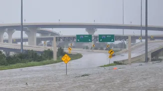
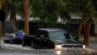
The impact on the ground is profoundly different. Think of it like watering a plant. A slow, steady drip allows the soil to absorb the moisture. But pouring a whole bucket of water on it at once will just cause the water to run off, eroding the soil and failing to hydrate the roots. Similarly, when rain is spread out over days and weeks, natural landscapes and drainage systems can manage the flow. But when a month's worth of rain falls in a few hours, it overwhelms everything. The ground becomes saturated almost instantly, and the excess water has nowhere to go. This is when we see streets turn into rivers and low-lying areas fill up with alarming speed, a phenomenon known as pluvial or surface water flooding.
The Urban Amplifier: A Concrete Problem
Nowhere is the danger of extreme rainfall more apparent than in our cities. Rapid and often unplanned urbanisation has replaced permeable surfaces like soil, parks, and wetlands with impermeable concrete and asphalt. These hard surfaces prevent rainwater from seeping into the ground, forcing nearly all of it into surface runoff. This deluge rushes into drainage systems that are often old, poorly maintained, or simply not designed to handle such intense volumes. For example, Mumbai's drains were built to handle about 25 mm of rain per hour, but the city now faces downpours that far exceed 100 mm per hour. The rampant encroachment on natural floodplains and the disappearance of urban lakes and wetlands have further destroyed the landscape's natural ability to act as a sponge.
The Verdict: Intensity Trumps Totals for Flood Risk
So, what matters more? While total monsoon rainfall remains a crucial indicator for our agricultural economy and water security, it has become a poor predictor of urban flood risk. A city can experience catastrophic flooding during a season that is officially declared 'normal' or even 'deficient' in terms of total rainfall. The evidence is clear: for understanding and mitigating the immediate, destructive power of modern floods, rainfall intensity is the metric that matters most. The focus for urban planners, disaster management agencies, and citizens must shift. Preparing for today's monsoon is no longer just about managing the seasonal total; it is about building resilience against short, brutal bursts of extreme rain.