





The Predictable Problem of Monsoon Gridlock
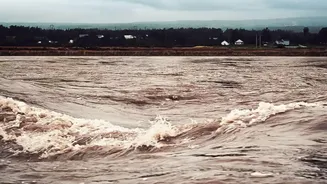
For urban commuters in India, the monsoon brings a mix of relief and dread. The relief from scorching heat is often short-lived, replaced by the stress of navigating waterlogged streets. Key arterial roads and underpasses become impassable within hours
of a heavy downpour, creating a domino effect that paralyses entire sections of a city. This annual ordeal isn't just an inconvenience; it leads to lost productivity, immense fuel wastage, and significant economic disruption. Traditional methods of flood management, such as manual inspections and CCTV monitoring, are often reactive. By the time authorities realise a critical point is flooded, it's usually too late, and thousands of vehicles are already trapped.
What Are Smart Water Sensors?
Enter the smart water sensor. These are not your average plumbing tools. They are rugged, compact devices, often powered by solar energy, and equipped with Internet of Things (IoT) technology. Deployed in strategic, flood-prone locations like storm-water drains, underpasses, and riverbeds, their primary job is to measure the water level in real-time. Using technologies like ultrasonic waves, radar, or LiDAR, these sensors continuously monitor water depth. This data is then transmitted wirelessly, using SIM cards or other network protocols, to a central command centre every few minutes. This creates a live map of a city's water situation, replacing guesswork with precise, actionable data.
From Real-Time Data to Proactive Action
The 'smart' element lies in what happens next. When water levels at a specific location cross a predefined critical threshold, the system triggers an automatic alert. This alert is instantly sent to the city’s disaster management cell and, crucially, to the traffic police. Instead of waiting for a citizen's complaint or a visual confirmation from a camera feed, traffic officials get a head start. This allows them to make proactive decisions. The system enables authorities to anticipate which areas will flood and take preventive action, turning a reactive crisis management situation into a proactive, data-driven operation.
Diverting Traffic Before Disaster Strikes
This is where the sensors directly combat gridlock. Armed with an early warning, the traffic police can close off entry to an underpass or a road that is about to become submerged. They can immediately update digital signboards on major roads and send out alerts through public navigation apps and social media, guiding commuters to alternative routes. This pre-emptive rerouting is the key. It stops vehicles from entering a bottleneck, preventing the pile-up before it begins. The goal is to manage traffic flow around a problem area, rather than dealing with a massive jam within it. This keeps the city moving, albeit with detours, and prevents the widespread paralysis that typically follows a monsoon deluge.
Indian Cities Deploying the Technology
This isn't just theoretical. Several Indian cities are already in the process of implementing this technology. The Municipal Corporation of Gurugram (MCG) has started installing sensors in key sewer lines and flood-prone zones, partnering with an IIT Gandhinagar-incubated startup to provide real-time alerts. The Brihanmumbai Municipal Corporation (BMC) in Mumbai is also rolling out a comprehensive network of sensors in rivers and storm-water drains as part of a major flood control plan. After identifying hundreds of chronic flooding spots, the BMC is moving from reliance on CCTV to precise, automated alerts. Similarly, Kolkata has worked on deploying a wide-ranging sensor network to gather inundation data and provide early warnings to citizens.
More Than Just Traffic Management
The benefits of these sensors extend beyond preventing traffic jams. The continuous stream of data helps municipal corporations understand drainage patterns and identify chronic blockages that need engineering solutions. It allows for faster deployment of dewatering pumps and emergency response teams to the exact locations where they are needed most. Furthermore, when integrated with AI and machine learning, this historical and real-time data can be used to create predictive models, forecasting potential floods hours or even days in advance. This transforms urban planning, allowing cities to build more resilient infrastructure for the future.