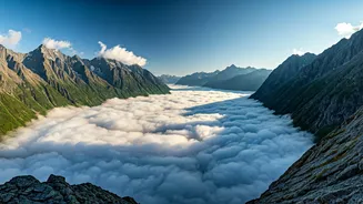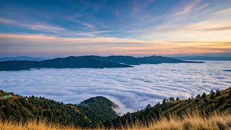


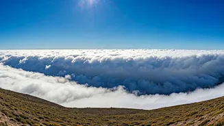


A 'Cloud Sea' at Your Feet
Across viewpoints in Himachal Pradesh, Uttarakhand, and Kashmir, visitors and locals have been treated to a spectacular natural display. The phenomenon, often called a 'cloud sea' or 'cloud inversion,' occurs when a dense layer of mist and clouds settles
in the valleys, while mountain peaks and higher ridges poke out into clear, sunny skies. From above, it looks as if the world has been flooded by a gentle, fluffy ocean. Photos and videos capturing this serene landscape—from Shimla’s Jakhoo Temple to Mussoorie’s Lal Tibba—showcase a world turned upside down, where you stand on an island in a sky-bound ocean. It’s a moment of profound peace and wonder, a powerful reminder of nature’s artistry. But this beautiful scene is the direct result of a large-scale weather pattern known as a Western Disturbance.
What Exactly is a Western Disturbance?
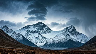
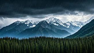
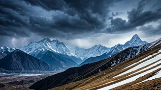
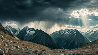
The term sounds technical, but the concept is straightforward. A Western Disturbance (WD) is an extratropical storm system that originates in the Mediterranean Sea region. Propelled by high-altitude westerly winds, these systems travel eastwards across the Middle East and Afghanistan before arriving over the Indian subcontinent. They are not monsoon-related storms; instead, they are the primary source of precipitation during the non-monsoon months, especially in winter. When a WD moves across Northern India, it brings a sudden change in weather—clouds, rain in the plains, and, most famously, snow in the high-altitude regions of the Himalayas. According to the India Meteorological Department (IMD), these systems are crucial for the region's climate and water security.
The Science Behind the Surreal View
So, how does a storm system from the Mediterranean create a sea of clouds in an Indian valley? The magic lies in a process called temperature inversion. Typically, air gets colder as you go higher. But under certain conditions, a layer of warm air can trap a layer of cooler, denser air beneath it. A Western Disturbance is perfect for creating this scenario. It brings abundant moisture into the lower atmosphere of the Himalayan foothills. As night falls and temperatures drop, this moisture condenses into a thick blanket of fog and low-lying stratus clouds in the valleys. However, the air above this layer remains warmer and clearer. When the sun rises, anyone standing on a peak above the inversion layer is greeted with sunshine and a spectacular view of the cloud-filled valley below. The hills and mountains effectively act as a basin, holding the mist captive until the sun becomes strong enough to burn it off.
More Than Just a Pretty Picture
While the misty overlooks are a gift for photographers and tourists, Western Disturbances play a vital role in the ecology and economy of Northern India. The winter precipitation they bring is essential for replenishing glaciers, which feed the perennial rivers of the Indo-Gangetic plains. This moisture is also critical for the rabi crops, particularly wheat, which is a staple for a huge portion of the country. However, their impact isn't always benign. Intense Western Disturbances can lead to extreme weather events, including heavy snowfall that cuts off remote communities, avalanches in the mountains, and crop damage from hailstorms in the plains. They are a perfect example of nature’s duality—a source of both life-sustaining water and immense beauty, but also of potential hazard. Understanding them is key to forecasting weather and managing resources in one of India's most sensitive ecological zones.