


The Power of the Crowd
The single most frustrating part of navigating a city during a downpour is the uncertainty. Is your usual route clear, or is it a meter deep in water? This is where crowdsourced software changes the game. The concept is simple but powerful: thousands
of individual users on the road act as real-time sensors. When they encounter a flooded street, a fallen tree, or a major traffic jam, they can report it directly on their navigation app. This data is instantly aggregated and displayed on the map for all other users to see. Instead of relying solely on satellite data or official reports, which can be slow to update, you get a live-from-the-ground picture of the situation. It’s a digital form of community watch, where every driver sharing information helps make the roads safer and more predictable for everyone else.
Your Go-To Navigation Apps
You likely already have the most powerful tools for this on your phone. The key is knowing how to use their crowdsourcing features effectively during an emergency.
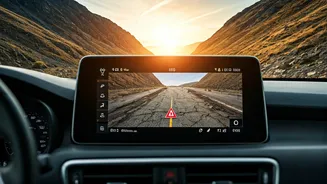
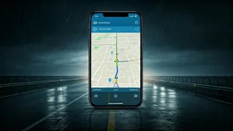
Google Maps: The most ubiquitous navigation app in India, Google Maps has robust features for real-time hazard reporting. When you see a blocked road or a hazard, you can tap the ‘Report’ icon (a speech bubble with a plus sign). You can then select the type of incident, including ‘Flooding’. Your report helps the app’s algorithm reroute other drivers. When you plan a route, the app will now often proactively warn you if your path goes through a flood-affected area, suggesting safer alternatives.
Waze: Owned by Google but operating as a separate community-based platform, Waze is built entirely around user reports. Its interface is designed for active reporting of everything from police presence to potholes and, crucially, weather hazards like floods. Waze users are typically very active, meaning hazard information in dense urban areas can be extremely current. The app’s bright, icon-heavy display makes it easy to spot reported floods and other obstructions on your map at a glance.
How to Contribute and Be a Good Digital Citizen
These systems only work if people participate. By adding your own observations, you contribute to a more accurate and reliable map for your entire community. However, safety is paramount. Never attempt to use your phone while driving. If you have a co-passenger, they can make the report. If you are alone, pull over to a safe location before reporting an incident. When you make a report, be as accurate as possible. If the app allows, confirm other users' reports if you can see the same hazard. This verification process helps the system distinguish between genuine, persistent problems and fleeting or inaccurate reports. Your small action, when combined with hundreds of others, creates a powerful safety net.
Understanding the Limitations
While incredibly useful, crowdsourced data is not infallible. Its effectiveness depends on the number of active users in a given area. In a dense city like Mumbai or Bengaluru, the data is likely to be very current during a storm. On a more remote road, you may be the first one to encounter a problem. Information can also be delayed; a road reported as flooded an hour ago may have cleared, or vice versa. Therefore, these apps should be treated as a vital decision-making aid, not an absolute guarantee of safety. Always use your own judgment. If a road looks dangerously flooded, do not attempt to cross it, even if the app shows it as clear. Local knowledge and visual confirmation should always take precedence.
Beyond the Apps: Official Alerts
Supplement your crowdsourced maps with official information. Follow the India Meteorological Department (IMD) for weather forecasts and warnings. Many municipal corporations now use social media, especially Twitter, to provide real-time updates on waterlogging and traffic diversions. State Disaster Management Authority websites and apps (like the KSDMA’s ‘Sachet’ app in Kerala) can also provide region-specific alerts and instructions. Combining the micro-level view from crowdsourced apps with the macro-level view from official sources gives you the most complete picture to navigate safely.