









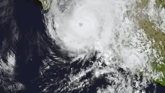
What is Cyclone Akvan's Current Status?
As of early morning on November 18, Cyclone Akvan has intensified into a Severe Cyclonic Storm over the west-central Bay of Bengal. The system is currently located approximately 610 km southeast of Machilipatnam and 610 km south-southeast of Visakhapatnam
in Andhra Pradesh. It has been moving slowly in a north-northwestward direction. The IMD forecasts that it will continue to strengthen, reaching the 'Very Severe Cyclonic Storm' category by the evening of November 19. This intensification means the storm is gathering more power, with increasing wind speeds and potential for significant impact upon landfall.
Projected Path and Landfall
The primary area of concern is the coast of Andhra Pradesh. According to the latest IMD bulletins, Cyclone Akvan is expected to make landfall between Nellore and Visakhapatnam around noon on November 20. While the exact landfall point is monitored continuously, coastal districts in this stretch are on high alert. Neighbouring states are also preparing for the cyclone's effects. Southern Odisha is expected to receive heavy rainfall, with orange and yellow warnings issued for districts like Ganjam, Gajapati, and Kandhamal. Parts of Telangana and West Bengal may also experience rainfall between November 19 and 21.
Understanding a 'Very Severe' Storm
The IMD uses a specific scale to classify the intensity of cyclonic storms based on their maximum sustained wind speed. A 'Very Severe Cyclonic Storm' (VSCS) is a powerful and dangerous system with sustained wind speeds of 118 to 166 kilometres per hour. For Cyclone Akvan, winds at landfall are predicted to be in the range of 120-130 kmph, with gusts reaching up to 145 kmph. Winds of this magnitude can cause significant damage to infrastructure, including poorly constructed houses, power and communication lines, and widespread damage to crops. In addition to the wind, a major threat is the storm surge—a rise in sea level—which is projected to be up to two metres high along the Andhra Pradesh coast.
Official Warnings and Advisories
The IMD has issued a series of warnings for the regions in the cyclone's path. Extremely heavy rainfall is expected over coastal Andhra Pradesh on November 19 and 20. Fishermen have been strongly advised not to venture into the west-central Bay of Bengal until after the storm passes, as sea conditions will be very rough to phenomenal. For the general public in coastal areas, the warnings are a signal to prepare for impact. The IMD's multi-stage warning system, which includes a 'Cyclone Alert' (Orange message) and 'Cyclone Warning' (Red message), is designed to give authorities and residents time to prepare. These alerts are disseminated through various channels to ensure they reach everyone at risk.
How Authorities and Communities Should Prepare
State governments in Andhra Pradesh and Odisha have already begun preparedness measures. This includes readying rescue teams from the National Disaster Response Force (NDRF) for deployment, identifying vulnerable areas for potential evacuation, and instructing local officials to take all precautionary steps. In Odisha, authorities have started controlled water release from some dams to create storage capacity for the expected heavy rains. For residents in the affected zones, it is crucial to follow official instructions. This includes securing your home, keeping an emergency kit with essentials like food, water, and first aid, and being prepared to move to designated cyclone shelters if an evacuation order is given. It is also vital to stay away from the coast and to avoid spreading or believing unofficial rumours.