







India’s Watchtowers in Orbit
The OceanSat programme is a series of earth observation satellites developed by the Indian Space Research Organisation (ISRO) dedicated to oceanography and atmospheric studies. The journey began with Oceansat-1 in 1999 and continued with Oceansat-2 in 2009.
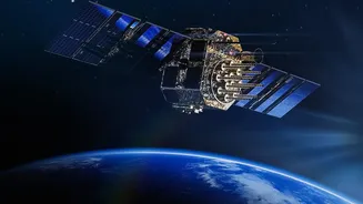
The latest in this lineage, Oceansat-3 (also known as EOS-06), was successfully launched in November 2022. These satellites are designed to provide continuity of data for oceanographic research and services, but with increasingly advanced instruments. The EOS-06, for instance, carries four key payloads: an Ocean Colour Monitor (OCM-3), a Sea Surface Temperature Monitor (SSTM), a Ku-Band Scatterometer, and an ARGOS communication payload. Together, these instruments provide a comprehensive suite of data about the conditions on and above our oceans, serving as a cornerstone of India’s ‘blue economy’ ambitions.
Decoding the Ocean’s Colours
The magic behind tracking fish populations begins with the Ocean Colour Monitor (OCM). This instrument is essentially a highly sophisticated camera that measures the light radiating from the ocean in multiple specific wavelengths, or colours. The colour of the ocean water changes based on what's in it. One of the key substances the OCM looks for is chlorophyll, the pigment found in microscopic marine plants called phytoplankton. Just like plants on land, these phytoplankton form the base of the marine food web. By measuring the concentration of chlorophyll, scientists can create detailed maps showing where these phytoplankton are blooming. The data from Oceansat-3's advanced 13-channel OCM allows for daily monitoring of these blooms with enhanced accuracy.
A High-Tech Guide for Fishermen
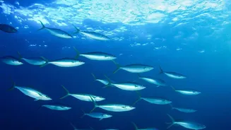
So, how does knowing about phytoplankton help a fisherman in Rameshwaram or Porbandar? The connection is simple: where there is phytoplankton, there are zooplankton that feed on them. And where there are zooplankton, you will find fish. This predictable food chain allows scientists to identify 'Potential Fishing Zones' (PFZ). ISRO provides this satellite data to the Indian National Centre for Ocean Information Services (INCOIS). INCOIS then combines the chlorophyll data from the OCM with sea surface temperature data to create detailed PFZ advisories. These advisories, indicating the most probable locations for fish aggregation, are disseminated daily to fishing communities across the country in nine regional languages through various platforms, including specialised GPS devices and mobile apps. This service saves fishermen valuable time and fuel by preventing a blind search for fish shoals, directly boosting their income and reducing carbon emissions.
A Watchful Eye on Gathering Storms
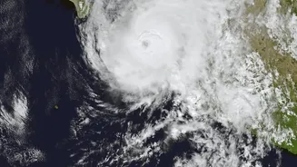
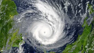
The OceanSat series is not just a tool for economic prosperity; it's a critical instrument for saving lives. Tropical cyclones feed on the heat of the ocean. The Sea Surface Temperature Monitor (SSTM) on EOS-06 measures the temperature of the ocean's surface, a key factor in the formation and intensification of cyclones. Complementing this is the scatterometer, an active microwave radar that measures the roughness of the sea surface to determine wind speed and direction with high resolution. This wind vector data is crucial for forecasters tracking the path of a developing cyclone. By feeding this precise, near real-time data into weather models, agencies like the India Meteorological Department (IMD) can issue more accurate and timely warnings about cyclone formation, movement, and potential landfall. This gives disaster management authorities precious time to prepare and evacuate coastal communities, minimising loss of life and property.