




Forecasting the Fury of the Skies
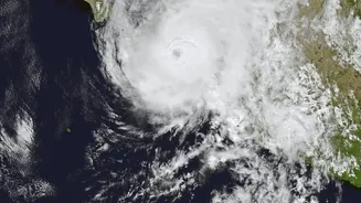
When a cyclone brews in the Bay of Bengal or the monsoon clouds gather, the India Meteorological Department (IMD) relies heavily on satellite data for accurate predictions. A key part of this is India's own series of geostationary satellites, like the INSAT
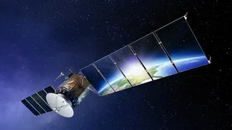
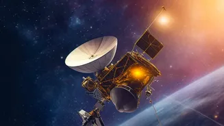
series, including INSAT-3D and INSAT-3DR. Positioned in a fixed spot above the Earth, they provide continuous, real-time imagery of the subcontinent. These satellites are equipped with imagers and sounders that do more than just take pictures. The imagers capture cloud movements and system intensity, while the sounders analyse the vertical profile of the atmosphere, measuring temperature and humidity at different altitudes. This allows meteorologists to track the development of weather systems, issue timely warnings for cyclones and heavy rainfall, and save countless lives. The data is updated as frequently as every 15 minutes, giving forecasters a dynamic view of changing conditions.
A Farmer's Best Friend in Orbit
For a nation where agriculture is a cornerstone of the economy, satellites have become an indispensable tool. Before this technology, assessing crop health across a state was a laborious process of physical field surveys. Now, Earth observation satellites can assess millions of fields in a single pass. Through programmes like FASAL (Forecasting Agricultural output using Space, Agro-meteorology and Land-based observations), the government uses satellite data to generate pre-harvest production estimates for major crops like rice, wheat, and cotton. Satellites do this by looking at crops in ways the human eye cannot. They use multispectral imaging to see how plants reflect different wavelengths of light. Healthy vegetation, for instance, has a distinct signature compared to crops that are stressed due to lack of water, pests, or disease. This allows for early detection of problems, often before they are visible on the ground. This information also supports crop insurance schemes like the Pradhan Mantri Fasal Bima Yojana (PMFBY) by providing accurate data for assessing crop damage and settling claims.
Gauging the Health of the Planet
Climate change presents long-term challenges, and satellites are crucial for monitoring its impact on India. One of the most critical areas of observation is the Himalayas, often called the 'Third Pole'. ISRO's satellites, such as those in the Cartosat and Resourcesat series, help scientists measure the retreat of glaciers and monitor the expansion of glacial lakes. This is vital for assessing the risk of Glacial Lake Outburst Floods (GLOFs), which can cause catastrophic damage downstream. Satellites also track other key climate indicators. They measure sea-level rise, monitor changes in forest cover which acts as a carbon sink, and track patterns of extreme rainfall. The upcoming NASA-ISRO Synthetic Aperture Radar (NISAR) mission, a joint project, will use advanced radar to monitor these changes with unprecedented detail, even through clouds, tracking everything from soil moisture to the stability of ice sheets.
The Technology Behind the Vision
The magic of satellite monitoring lies in the sophisticated instruments they carry. Optical sensors, like those on many Resourcesat missions, capture images in visible and infrared light, which are excellent for assessing vegetation health. However, their main limitation is that they cannot see through clouds, a major issue during the monsoon season. This is where Synthetic Aperture Radar (SAR) comes in. Satellites equipped with SAR, like India's RISAT series and the upcoming NISAR, can penetrate cloud cover and operate day or night. Radar is sensitive to the structure of vegetation and the moisture content in the soil, providing a reliable stream of data when optical sensors are blinded. By combining information from both optical and radar satellites, Indian agencies can build a comprehensive and uninterrupted picture of the land, weather, and water, ensuring that decision-makers have the best possible information at their fingertips.