







India's New Sentinel in the Sky
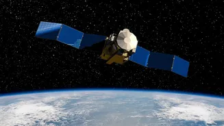
The EOS-05 is the latest in India's series of advanced Earth Observation Satellites, but it's a special one. Launched on September 4 from Sriharikota, it is described as a state-of-the-art spacecraft and India's first imaging satellite designed to operate
from a geosynchronous orbit. Unlike satellites in Low Earth Orbit (LEO) that orbit the planet every couple of hours, EOS-05 is destined for a much higher perch. Its primary mission is to provide continuous, high-frequency imaging of large geographical areas. This capability is crucial for a wide range of applications, from disaster monitoring and border surveillance to tracking forest fires and assessing crop health across the subcontinent.
The Long Climb to 36,000 Kilometres
A satellite like EOS-05 isn't simply placed in its final orbit. First, the powerful GSLV-F17 rocket injected it into a highly elliptical path called a Geosynchronous Transfer Orbit (GTO). This initial orbit had a very low point (perigee) and a very high point (apogee). From there, the real work began for the scientists at ISRO's Telemetry, Tracking and Command Network (ISTRAC) in Bengaluru. Over several days, they meticulously executed a series of engine firings, known as orbit-raising manoeuvres. Each firing of the satellite's onboard Liquid Apogee Motor (LAM) nudged it higher, circularising its path. The latest manoeuvre raised the satellite to the orbit mentioned in the headline—a perigee of 34,903 km and an apogee of 35,884 km, bringing it very close to its final operational circular orbit.
Why This 'Stationary' Orbit is a Game-Changer
The goal is a geostationary orbit, a special path about 35,786 km directly above the equator. In this orbit, a satellite's speed perfectly matches the Earth's rotation. From the ground, it appears to hang motionless in a fixed position in the sky. This is a huge advantage. While a LEO satellite might get a few minutes of imagery of a specific area per day, a geostationary satellite like EOS-05 can provide constant watch. This allows for near real-time monitoring of weather patterns, the progress of a flood or cyclone, or other rapidly developing events. Just three such satellites, properly spaced, can provide near-global coverage.
What EOS-05 Means for India
The successful positioning of EOS-05 is a testament to ISRO's increasing mastery over complex space operations. For the average Indian, the benefits will be tangible. The data from EOS-05 and its sister satellites feed into crucial national systems. These include giving fishermen advisories on potential fishing zones, providing farmers with crop health data, helping urban planners manage city growth, and enabling disaster management teams to respond more effectively. Furthermore, a dedicated eye in the sky enhances the nation's security apparatus, allowing for constant surveillance of our borders and maritime interests. This mission reinforces India's self-reliance in developing and deploying space technologies for national development.