






An Eye in the Sky for Every Drop
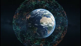
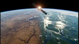
The first part of this technological duo is the satellite. For decades, satellites have been indispensable tools for monitoring Earth's environment, but their role in water management is becoming increasingly critical. These orbiting observers are equipped
with sophisticated sensors that can see what the human eye cannot. For instance, satellites like NASA's Gravity Recovery and Climate Experiment (GRACE) mission and its successor, GRACE-FO, don't take pictures of water but measure tiny changes in Earth's gravity field. These fluctuations can indicate changes in the total amount of water stored underground in aquifers. Other satellites use radar to detect minute changes in the ground's surface elevation—a key sign of land subsiding as groundwater is depleted. Meanwhile, optical and infrared sensors track everything from rainfall patterns and river levels to soil moisture, providing a comprehensive, real-time picture of the water cycle across vast and often inaccessible areas. This is far more efficient than relying solely on ground-based measurements, which can be expensive and sparse.
The AI Analyst: Making Sense of the Data
Collecting terabytes of data from space is one thing; turning it into actionable intelligence is another. This is where Artificial Intelligence (AI) comes in. AI, particularly machine learning, excels at sifting through massive datasets to identify patterns, anomalies, and trends that would be impossible for humans to spot. When fed with satellite data, AI algorithms can learn the complex relationships between rainfall, soil moisture, ground elevation, and underground water levels. By combining historical data with real-time sensor inputs, these AI models can predict future groundwater levels with high accuracy, forecast potential floods, and even detect the early signs of drought. This predictive power transforms water management from a reactive practice—dealing with crises as they happen—to a proactive one, allowing authorities to prepare and mitigate risks before they escalate.
Tackling India’s Water Woes
The applications for India are profound. With nearly 600 million people facing high to extreme water stress, this technology is not just an academic exercise. In states like Haryana, an AI-enabled 'Water Atlas' already integrates geospatial, satellite, and IoT data for real-time monitoring of ground and surface water systems, helping to optimise conservation and allocation. In agriculture, which consumes the vast majority of India's water, AI-powered systems can use satellite data on soil moisture to enable precision irrigation, delivering water exactly when and where it's needed and reducing waste. For cities, the technology offers a way to get ahead of urban flooding by creating predictive models and to manage scarce resources more effectively. For example, the Nagpur Municipal Corporation has already used AI and IoT to significantly reduce its Non-Revenue Water (water lost to leaks and theft). Even water quality can be monitored from space, with AI helping to detect pollution or harmful algal blooms.
Challenges on the Horizon
Despite its immense potential, the technology is not a silver bullet. One of the biggest hurdles is ensuring data quality and consistency. Cloud cover can obscure optical satellite imagery, especially in tropical regions during monsoon season, potentially biasing analyses. Integrating data from different satellites, which operate on different schedules and resolutions, can also be complex. Furthermore, satellite data always benefits from "ground-truthing"—calibrating the space-based observations with on-the-ground measurements to ensure accuracy. Finally, adopting this technology requires significant investment in training, software, and institutional support to translate the data into effective policy and on-ground action. Building the capacity for municipal personnel and farmers to use these new tools is a critical step for widespread success.