



A New Sentinel in Orbit
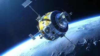
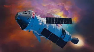
The NASA-ISRO Synthetic Aperture Radar, or NISAR, is a sophisticated Earth observation satellite that represents a major milestone in the space partnership between the United States and India. Launched in mid-2025, this state-of-the-art spacecraft is now
orbiting 747 kilometres above Earth, equipped with advanced radar instruments designed to monitor our planet's complex processes with unprecedented detail. Its primary mission is to track changes in Earth's land and ice surfaces, providing a wealth of data crucial for understanding climate change, managing resources, and, most critically, enhancing disaster management. All data from the mission is made freely and openly available to the public, ensuring scientists, disaster response agencies, and researchers in India and worldwide have access to its insights.
The Power of All-Weather Vision
What makes NISAR a game-changer is its use of Synthetic Aperture Radar (SAR). Unlike optical satellites that are essentially cameras in space, SAR can 'see' through clouds, darkness, and even dense vegetation. This is invaluable during a crisis like a cyclone or widespread flooding, when heavy cloud cover often renders traditional satellites useless. NISAR is the first satellite mission to use two different radar frequencies—the L-band (from NASA) and the S-band (from ISRO)—which work together to create detailed, 3D maps of the surface. This dual-frequency capability allows it to measure changes on the ground as small as a centimetre, providing a new level of precision.
From Reactive to Proactive Planning
One of NISAR's most significant contributions is its ability to help officials anticipate disasters before they strike. By scanning nearly the entire planet every 12 days, the satellite creates a consistent, time-lapse view of Earth’s surface. This data can reveal subtle, slow-moving ground deformation that could be a precursor to landslides in vulnerable regions like the Himalayas or Western Ghats. It can also monitor land subsidence in rapidly growing urban areas, an issue often linked to groundwater extraction, which can damage infrastructure and increase flood risk. By identifying where tectonic stress is building along fault lines, scientists can better assess earthquake risk and help communities prepare.
Real-Time Intelligence During a Crisis
When a disaster does occur, speed and accuracy are everything. NISAR's all-weather capability provides uninterrupted monitoring, delivering critical information to emergency response teams on the ground. For example, during a major flood event like those seen in the Brahmaputra basin, NISAR can precisely map the extent of inundation, even under thick monsoon clouds. This helps authorities identify the worst-hit areas, locate stranded populations, and plan rescue and relief routes more effectively. The mission has an urgent response mode that can be automatically activated after a major event like an earthquake, prioritizing data processing to get information to disaster management agencies within hours.
Assessing Damage and Aiding Recovery
After the immediate crisis has passed, the long road to recovery begins. NISAR's high-resolution imagery is invaluable for conducting rapid and accurate damage assessments. The data can help authorities quantify the impact on agriculture, infrastructure like roads and bridges, and human settlements. This information is vital for deploying resources efficiently, guiding rebuilding efforts, and streamlining insurance claims. For a country with vast agricultural lands, the ability to distinguish between different crop types and assess damage from flood or drought supports food security and economic recovery. The data for India, processed at ISRO's facility in Shadnagar, is now being regularly released to the public, empowering a new era of data-driven governance and recovery planning.