






A Mission Accomplished, Not Failed
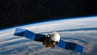
While the headline specifies EOS-05, a recently launched satellite, the concept of a satellite's 'final orbit' is best understood through the lens of older spacecraft that have successfully completed their missions. A prime example is the Megha-Tropiques-1
(MT-1) satellite, a joint Indo-French mission launched in 2011 to study tropical weather and climate. Designed for a three-year mission, it served for over a decade, providing crucial data that enhanced weather models. Similarly, satellites like Oceansat-2, launched in 2009, far outlived their expected service lives, contributing vital information on ocean conditions, forecasting monsoons, and monitoring aquatic resources. These workhorses in the sky are not failures when they are retired; their retirement is a planned event, marking the successful conclusion of a long and productive service life. Their data supports everything from disaster management and urban planning to agriculture and mineral prospecting.
The Challenge of a Crowded Sky
So why bring a satellite down at all? The answer is space debris. Low Earth Orbit (LEO), the region where many observation satellites operate, is becoming dangerously cluttered with defunct satellites, spent rocket stages, and fragments from past collisions. These objects travel at incredible speeds, and a collision can be catastrophic, destroying operational satellites and creating even more debris in a chain reaction known as the Kessler Syndrome. Leaving a 1,000-kg satellite like Megha-Tropiques-1 to drift uncontrolled for the 100-plus years it might take to naturally de-orbit would pose an unacceptable risk. Its unspent fuel could even cause an accidental break-up, worsening the debris problem. Managing the end-of-life for these assets is therefore a critical part of being a responsible space-faring nation.
A Controlled and Complex Descent
Bringing a satellite down safely is a highly complex manoeuvre. In the case of Megha-Tropiques-1, ISRO undertook what it called an "extremely challenging" controlled re-entry. Over several months starting in August 2022, engineers performed a series of 20 manoeuvres to gradually lower the satellite's orbit, using up its remaining 120 kg of fuel. The final burns guided the satellite into a precise trajectory, ensuring it would disintegrate over a pre-determined uninhabited area of the Pacific Ocean. This entire sequence was carefully managed to avoid any risk to other space objects, including the International Space Station and China's Tiangong station. Successfully executing such a controlled re-entry is a powerful demonstration of ISRO's advanced capabilities in flight dynamics, propulsion, and mission management.
A Mark of a Mature Space Program
Executing a controlled re-entry shows that India's space program has evolved from not just launching and operating satellites, but to managing their entire lifecycle. This aligns with international guidelines on space debris mitigation. ISRO's proactive stance is formalized in initiatives like the Debris Free Space Mission (DFSM), which aims for zero debris by 2030, and the establishment of ISRO System for Safe and Sustainable Space Operations Management (IS4OM). These efforts ensure that as India launches more assets, it is also taking responsibility for keeping space sustainable for future generations. This end-to-end management capability signals a new level of maturity and solidifies India's reputation as a conscientious global space power.
The Next Generation of Eyes in the Sky
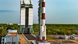
The retirement of one satellite does not create a gap in India's monitoring capabilities. In fact, it is part of a planned cycle of renewal and technological advancement. Today, India operates one of the world's largest constellations of remote sensing satellites. Newer satellites, like the recently launched EOS-05 (also known as GISAT-1A), represent a significant leap forward. Unlike older satellites in LEO that pass over a location periodically, EOS-05 operates from a geosynchronous orbit about 36,000 km high. This allows it to provide near-constant, real-time imagery of the Indian subcontinent, a game-changer for disaster management, military surveillance, and resource monitoring. This constant watch capability dramatically reduces the time needed to get updated images, from hours or a day to mere minutes. This continuous evolution ensures that India's eyes in the sky are not only replaced but are becoming sharper and more powerful over time.