







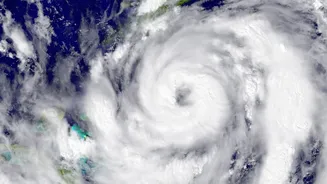


A 'very severe cyclonic storm' named Arnab made landfall on the Andhra Pradesh coast on Wednesday morning, bringing torrential rains and high-speed winds. The India Meteorological Department (IMD) has issued alerts for several states.
Cyclone Arnab Makes Landfall
The cyclone crossed
the coastline near Yanam between 2 a.m. and 8 a.m. on October 28. The IMD confirmed the completion of the landfall process by mid-morning, with the system moving entirely over land. At its peak during landfall, the storm was classified as a 'very severe cyclonic storm' with sustained wind speeds of 125–135 kmph, gusting up to 150 kmph. After crossing the coast, the system weakened into a 'severe cyclonic storm' and is expected to weaken further into a deep depression as it moves inland. The name 'Arnab', pronounced 'Ornab', was contributed by Bangladesh to the regional list of cyclone names.
Andhra Pradesh and Odisha on High Alert
Andhra Pradesh is bearing the brunt of the storm's impact. Extremely heavy rainfall has been recorded in several districts, including Visakhapatnam (315 mm), Vizianagaram (301 mm), and Anakapalli (275 mm) as of Wednesday morning. Strong winds have uprooted trees and disrupted power supplies across coastal regions. In neighbouring Odisha, the cyclone's outer bands have brought significant rainfall to southern districts like Koraput, Ganjam, and Gajapati. Authorities in both states took extensive precautionary measures, evacuating over 180,000 people from low-lying and vulnerable areas ahead of the storm's arrival. Schools were closed, and flight operations to airports like Visakhapatnam were cancelled. Fortunately, due to these proactive measures, no loss of life has been reported from either state in the initial hours after landfall.
Wider Impact Across Other States
The cyclone's influence extends far beyond the immediate coastline, altering weather patterns across central and northern India. The IMD has forecast heavy to very heavy rainfall for Telangana, Chhattisgarh, and the Vidarbha region of Maharashtra for October 28 and 29. The remnants of the storm are expected to move north-northwest, potentially interacting with a western disturbance. This interaction could bring unseasonal rainfall to East Uttar Pradesh, Bihar, Jharkhand, and even West Bengal later in the week. Alerts have been issued for thunderstorms and gusty winds in these regions, with authorities advising vigilance.
Safety Precautions and Official Advice
Even as the cyclone weakens over land, authorities are warning residents to remain cautious. The IMD has stressed that heavy rainfall will likely continue through Wednesday and Thursday, posing a risk of flooding in many areas. Citizens in affected regions are advised to avoid unnecessary travel and stay away from coastal areas. Officials have also warned against taking shelter under trees or near weak structures. It is crucial to follow instructions from local disaster management authorities and rely on official channels like the IMD for the latest updates rather than rumours. Rescue and relief teams from the NDRF, SDRF, and armed forces are deployed and on standby to restore essential services and manage any emergencies.