








A Mission of Redemption
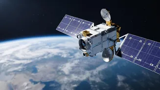
The story of EOS-05 is one of perseverance. This state-of-the-art Earth observation satellite is, in fact, the successor to a nearly identical spacecraft, GISAT-1 (also known as EOS-03), which was lost during a launch failure in August 2021. That mission
ended when the GSLV rocket's cryogenic upper stage malfunctioned, preventing the satellite from reaching its intended orbit. The launch of EOS-05, scheduled for September 4, 2026, represents a second attempt at a crucial strategic goal: placing a high-resolution imaging satellite into a geosynchronous orbit, a feat ISRO has been working toward for years. This mission is not just about launching a satellite; it's about completing unfinished business and securing a long-awaited technological capability for the nation.
The Difference Is the Orbit
So, what makes this orbit so special? Most Earth observation satellites, like those in the Cartosat series, operate in a Low Earth Orbit (LEO), typically a few hundred kilometres up. Think of them as race cars on a track, circling the globe at high speed. They capture incredibly detailed images but can only see a specific location for a few minutes before they move on, sometimes taking days to revisit the same spot. A geosynchronous orbit is completely different. Located at a much higher altitude of about 36,000 kilometres, a satellite in this orbit matches the speed of Earth's rotation. A special type of this orbit, called geostationary, places the satellite directly over the equator, making it appear stationary from the ground. This transforms the satellite from a passing car into a fixed security camera in the sky.
The Power of a Constant Gaze
The ability to 'hover' over the Indian subcontinent unlocks a host of powerful applications. The key advantage is near-real-time monitoring. Instead of waiting for a satellite to pass over a developing situation, a geostationary imager can provide a continuous stream of updates. For a country that frequently faces natural disasters, this is a game-changer. Authorities could track the path of a cyclone, monitor the spread of forest fires, or observe rising floodwaters as they happen, allowing for faster and more effective response. The EOS-05 is designed to image the entire Indian landmass roughly every 30 minutes, and focus on specific areas of interest as frequently as every five minutes.
Beyond Weather and Disasters
The benefits of geosynchronous imaging extend far beyond disaster management. This persistent eye in the sky has significant strategic implications, offering the ability to constantly monitor borders and other areas of interest for national security. On the civilian front, the data can be used for a wide range of applications, including assessing crop health over large agricultural areas, managing water resources, and monitoring changes in forestry and the environment. By providing frequent, high-resolution imagery, EOS-05 will supply a vital stream of data to scientists, policymakers, and security agencies, improving planning and resource management across multiple sectors.
A High-Stakes Return to Flight
The launch of EOS-05 aboard the GSLV-F17 rocket is one of the most closely watched ISRO missions in recent memory. It follows the 2021 failure of its predecessor and comes after a challenging period that saw other unrelated launch setbacks. A successful mission would not only place a powerful new tool in orbit but also reaffirm the reliability of the GSLV launch vehicle and its domestically developed cryogenic engine. The rocket will first place the satellite into a sub-geosynchronous transfer orbit. From there, EOS-05 will use its own onboard propulsion system to perform a series of manoeuvres over several days to climb to its final, fixed position high above the Earth.