







A New Chapter for India's Watchful Eyes
The Indian Space Research Organisation (ISRO) is preparing to launch EOS-05, an advanced Earth observation satellite, aboard its GSLV-F17 rocket on September 4, 2026. This mission is not just another launch; it represents a renewed determination to achieve
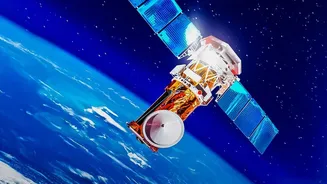
a highly ambitious goal: stationing a high-resolution eye in a fixed position over the Indian subcontinent. Known also as GISAT-1A, EOS-05 is the successor to the GISAT-1 mission, which was unfortunately lost during a launch failure in August 2021. Five years later, this mission signifies a crucial comeback, aiming to place a state-of-the-art sensor 36,000 kilometres above the Earth in a geostationary orbit. This will allow the satellite to 'stare' continuously at a large area, a capability that will fundamentally change how India monitors its land, borders, and weather.
From Mapping Fields to Monitoring Threats
India's Earth observation program, which began with the IRS-1A satellite in 1988, has created one of the world's largest constellations of remote sensing satellites. For decades, the primary focus was on developmental applications. Satellites like the Resourcesat series helped manage natural resources, Cartosat satellites enabled detailed urban planning and map-making, and the Oceansat series improved weather forecasting and ocean studies. While these satellites, which typically operate in low-Earth orbit, have been immensely valuable, they can only view a specific location when their orbit passes over it. The new focus, embodied by EOS-05, is on adding a persistent, real-time monitoring capability that serves both civilian and strategic needs. This shift reflects a growing understanding that space is an integral pillar of national security and economic resilience.
What Makes EOS-05 So Different?
The key difference lies in its orbit and its mission. By operating from a geostationary orbit, EOS-05 will remain in a fixed position relative to the Earth's surface. This unique vantage point will enable it to provide images of the entire Indian landmass approximately every 30 minutes. For specific areas of interest, it can be tasked to provide updates as frequently as every five minutes. This near-real-time capability is a game-changer for monitoring rapidly developing events like cyclones, floods, and forest fires. The satellite is equipped with multi-spectral and hyperspectral cameras, allowing it to see in various wavelengths of light, from visible to infrared. This provides rich data for everything from agriculture and mineralogy to military surveillance, all under cloud-free conditions.
The Strategic and Civilian Imperative
The ability to have a constant watch over a region has profound strategic implications. In an era of complex geopolitical challenges, persistent surveillance of borders and maritime areas is crucial for national security. A satellite like EOS-05 enhances this capability significantly, providing intelligence that is not dependent on the orbital pass of a satellite or the weather limitations of drones. But the benefits are equally transformative for civilian life. For disaster management agencies, the ability to get frequent updates during a flood or cyclone can be life-saving. Farmers can benefit from more precise data on crop health, and city planners can monitor urban expansion more effectively. By providing a continuous stream of data, EOS-05 will act as a powerful tool for governance, environmental monitoring, and economic development.