








The View From 36,000 Kilometres
For decades, India’s Earth observation satellites have operated from Low Earth Orbit (LEO), typically a few hundred to 2,000 kilometres up. While powerful, these satellites are like fast-moving trains, capturing high-resolution snapshots of an area before
speeding away and returning only after completing multiple orbits. This leaves significant gaps in coverage. The game changes at 36,000 kilometres in a geostationary orbit (GEO). At this specific altitude, a satellite’s orbital speed matches the Earth’s rotation. The effect is that the satellite remains fixed over the same spot on the planet, turning from a periodic visitor into a constant, unwavering observer. Instead of fleeting glimpses, it offers a 24/7 watch over a vast territory, a capability only a handful of nations possess.
India’s New Sentry: EOS-05
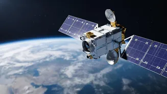
The satellite at the heart of this leap is ISRO's Earth Observation Satellite-05 (EOS-05), also known as Gisat-1A. Scheduled for a September launch aboard a GSLV rocket, it is India’s first imaging satellite designed for this high-altitude perch. From its geostationary post, EOS-05 will be able to image the entire Indian landmass at regular intervals, approximately every 30 minutes, and can be tasked to focus on specific areas of interest with a refresh rate as fast as every five minutes. While its primary role is strategic, its capabilities have broad civilian applications. The satellite's data will be invaluable for near-real-time monitoring of natural disasters like cyclones, floods, and forest fires, as well as for agriculture and environmental science.
A Force Multiplier For Security
The strategic implications for India's defence are immense. The continuous surveillance offered by EOS-05 will fundamentally enhance the nation's security posture. It grants the armed forces, coordinated by the Defence Space Agency (DSA), the ability to maintain a persistent watch over sensitive border areas, tracking troop movements and infrastructure build-up far beyond the Line of Control and the Line of Actual Control. This capability significantly shortens what military planners call the OODA loop: Observe, Orient, Decide, and Act. By detecting potential threats earlier and tracking their development continuously, decision-makers can respond faster and more effectively. Furthermore, the satellite will provide critical maritime domain awareness across the Indian Ocean, monitoring strategic choke points and naval traffic in India's vast areas of interest.
Part Of A Larger Cosmic Blueprint
EOS-05 is not a standalone marvel but a critical building block in a much grander vision for India’s space-based security. It is a key component of the ambitious Space-Based Surveillance (SBS) Phase-III program. Approved by the Cabinet Committee on Security, this program envisages a comprehensive constellation of 52 satellites operating in both low-earth and geostationary orbits. This multi-layered network is designed to provide robust, redundant, and persistent intelligence, surveillance, and reconnaissance (ISR) capabilities. The program also marks a strategic shift, with ISRO developing a portion of the satellites while the private sector is being engaged to build the rest, fostering a domestic defence-space ecosystem. This holistic approach indicates that India is moving beyond individual satellite capabilities and building an integrated, next-generation security architecture in orbit.