







A Constant Watch for Disasters
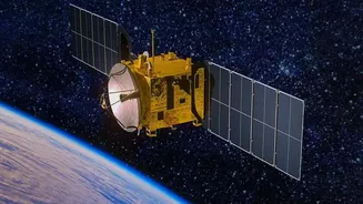
One of the most critical applications of EOS-05 is its ability to monitor natural disasters as they unfold. Unlike previous satellites that passed over a location periodically, EOS-05 is in a geosynchronous orbit, allowing it to stare continuously at the Indian
subcontinent. This provides an invaluable stream of data for tracking the formation and movement of cyclones, monitoring large-scale floods, and spotting forest fires the moment they start. For disaster management agencies, this near real-time information is crucial for issuing timely evacuation warnings, directing rescue teams to the worst-affected areas, and assessing the extent of damage to coordinate relief efforts more effectively.
Enhancing Strategic Surveillance
The satellite’s ability to provide persistent imagery has significant strategic importance. Positioned 36,000 km above the Earth, EOS-05 can keep a steady watch over India's borders and areas of interest in the surrounding region. This capability strengthens the nation's surveillance capacity, complementing the fleet of low-earth-orbit satellites that provide high-resolution images but revisit locations less frequently. The constant monitoring helps in observing and analysing movements or changes in sensitive zones, providing a crucial layer of intelligence for national security. The satellite's data is intended for both civilian and strategic applications, making it a dual-purpose national asset.
Aiding Agriculture and Water Management
Beyond security, EOS-05 is a powerful tool for managing the country's vital natural resources. Its multispectral imagers can assess the health of crops over vast agricultural belts, providing insights into soil moisture, pest infestations, and yield estimates. This information helps in making informed policy decisions related to food security and agricultural planning. Furthermore, the satellite can monitor water bodies, including reservoirs and rivers, helping authorities manage water resources more efficiently, especially during periods of drought or for equitable distribution. It can also track environmental changes like desertification and the health of our forests.
Smarter Urban Planning and Infrastructure
As India's cities continue to grow, managing urbanisation becomes increasingly complex. EOS-05 provides high-resolution data that can be used for effective urban planning. City planners can monitor urban sprawl, identify illegal construction, and plan for new infrastructure like roads, metro lines, and housing projects with greater accuracy. The satellite's imagery can help in creating updated maps, assessing land use changes, and ensuring that development is sustainable. By providing a comprehensive view of the urban landscape, it helps authorities make data-driven decisions to improve the quality of life in our cities.
Improving Weather and Climate Models
The satellite is also a key contributor to weather forecasting and climate science. Its state-of-the-art instruments provide continuous data on cloud cover, lightning, and atmospheric conditions, which can be fed into weather prediction models to improve their accuracy. This leads to better forecasts for everything from daily weather to severe storm warnings. Over the long term, the data gathered by EOS-05 on land and sea surface changes will contribute to a deeper understanding of climate change patterns and their impact on the Indian subcontinent, helping scientists and policymakers prepare for future environmental challenges.