


What Exactly Is a Cyclonic Circulation?
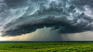
Before you picture a full-blown, named cyclone with a distinct 'eye', it's important to clarify. A cyclonic circulation is a low-pressure area with winds rotating around its centre—counter-clockwise in the Northern Hemisphere. Think of it as a cyclone's
less intense cousin. It doesn't have the destructive wind speeds of a tropical cyclone, but it is a master at gathering and organising moisture. These systems are common during the monsoon season and act as engines, pulling in moist air from over the sea and transporting it over land. The current system, positioned strategically over the northeast Arabian Sea and adjoining areas, has become a highly efficient conveyor belt for rain.
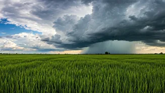
How It Channels Rain to Central India
Imagine a giant, slowly rotating fan placed over the sea. As it spins, it draws in the warm, humid air sitting just above the water's surface. This mass of moisture-laden air is then pushed eastwards across the coast. In this case, the circulation is interacting with the monsoon trough—an elongated low-pressure area that typically runs across northern India. This interaction strengthens the westerly winds blowing from the Arabian Sea, creating a powerful stream of moisture aimed directly at the country's mid-section. As this air travels over land, it rises, cools, and condenses, forming clouds that release their moisture as widespread rainfall across the central belts.
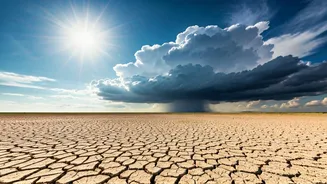
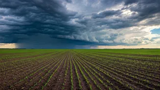
The Regions Getting Soaked
The primary beneficiaries of this weather event are the states that form the core of central India. According to the India Meteorological Department (IMD), widespread moderate to heavy rainfall has been reported across large parts of Madhya Pradesh, the Vidarbha region of Maharashtra, and Chhattisgarh. These areas have seen significant downpours, leading to a much-needed boost in rainfall statistics for the season. Some districts, particularly in western and central Madhya Pradesh, have received heavy to very heavy spells. This targeted delivery of rain is crucial as these regions are heavily dependent on monsoon showers for their agriculture and to replenish water reservoirs that supply towns and cities.
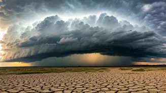
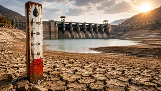
A Timely Boost for the Monsoon
This active spell comes at a critical time. The monsoon's performance can be erratic, with some regions experiencing deficits while others see a surplus. This cyclonic circulation is helping to balance the scales, at least for central India, where rainfall may have been lagging. By activating this corridor of moisture from the Arabian Sea, the system has reinvigorated the monsoon's progress in the region. Meteorologists note that such systems are vital for ensuring a healthy distribution of rainfall during the four-month season. Without them, the monsoon can enter a 'break' phase, leading to prolonged dry spells that can stress crops and water supplies.
Impact on Farming and Water Levels
For farmers, this rain is largely a blessing. It provides essential moisture for the sowing and growth of Kharif crops like soybean, cotton, and pulses, which dominate agriculture in this belt. The timing is crucial for ensuring healthy crop development. Beyond the farms, the rainfall is replenishing rivers and reservoirs that were running low. However, it's not without its challenges. Intense, concentrated spells of rain can lead to waterlogging in fields, which can damage young saplings. In urban areas, heavy downpours can overwhelm drainage systems, causing localised flooding and traffic disruptions. Authorities are monitoring the situation closely, advising caution in low-lying areas.