



The Big Picture from Space
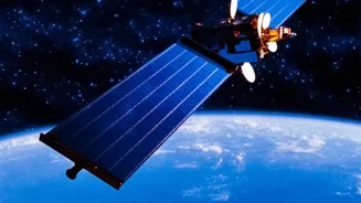
The first step in monitoring Kerala's vast and often inaccessible natural landscapes is to get a view from above. Scientists use remote sensing technology, where satellites orbiting Earth capture a stream of data about the planet's surface. These satellites are
equipped with advanced sensors that can see far more than the human eye. They measure light reflected from the Earth across different wavelengths, including infrared, to gather information on various environmental indicators. This data can reveal the density of forest cover, track changes in land use over months or years, measure surface water extent, and even estimate the health of vegetation by creating indices like the Normalised Difference Vegetation Index (NDVI). This gives conservationists and policymakers a large-scale, regularly updated map of the state's environmental health, allowing them to spot emerging trends like deforestation, urban sprawl, or the shrinking of water bodies.
The Indispensable Role of Field Surveys
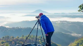
While satellite data provides an invaluable wide-angle view, it can't tell the whole story. A satellite might detect a loss of 'greenness' in a forest, but it can't identify the specific cause—is it a pest outbreak, an invasive species, or illegal logging? This is where field surveys, often called 'ground-truthing', become essential. Scientists, forest officials, and even local community members venture into these ecosystems to collect detailed, on-the-ground information. They identify plant and animal species, measure tree girth and height, test soil and water quality, and document specific threats. This granular data provides the 'why' behind the 'what' that satellites observe. For instance, a satellite survey might flag potential man-made structures in a sensitive zone, but a field survey is needed to verify what those structures are and their precise impact.
A Powerful Partnership
The true innovation lies in how these two methods are combined. The detailed data from field surveys is used to 'train' and validate the information gathered by satellites. Scientists take a known data point from a field visit—for example, a patch of forest confirmed to be a healthy, native species—and match it to its unique signature in the satellite image. This process, known as supervised classification, teaches computer algorithms to accurately identify similar ecosystem types across the entire satellite map. This synergy means that the accuracy of large-scale satellite mapping is massively improved, while the intensive, localised work of field surveys can be applied to a much wider area. The field data calibrates the satellite view, turning broad-strokes observations into a precise, reliable diagnostic tool.
From Data to Action in Kerala
This integrated approach is already yielding critical insights for Kerala. Organisations like the Kerala Forest Research Institute (KFRI) have long used remote sensing and GIS for tasks like biodiversity mapping and analysing forest dynamics. A recent initiative launched by the Kerala State Biodiversity Board (KSBB) aims to create a comprehensive Red List Assessment of all ecosystems in the state. This project evaluates the risk of collapse for habitats ranging from high-altitude grasslands to coastal mangroves, using the IUCN framework. By combining spatial data with field assessments, the project will produce detailed risk maps. This information empowers local bodies like panchayats to make evidence-based decisions for conservation, ecological restoration, and sustainable development, ensuring that Kerala's natural heritage is protected for generations to come.