


Eyes in the Sky, Feet on the Ground
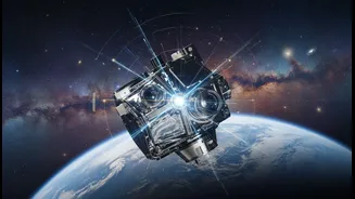
On one hand, you have modern science. Satellites orbiting hundreds of kilometres above Earth can map coastlines with incredible precision. They use sensors to track changes in shoreline position, measure the loss of land, and monitor the health of coastal
ecosystems like mangroves over vast areas. This technology gives researchers a big-picture view, allowing them to see trends happening at a scale that is impossible with traditional ground surveys alone. It's quantitative, data-driven, and provides a crucial baseline for understanding the physical mechanics of erosion. Scientists can see where land is disappearing year after year, offering objective evidence for planning and intervention.
The Wisdom of Generations
On the other hand, you have Indigenous coastal knowledge, often called Traditional Ecological Knowledge (TEK). This is a deep, cumulative body of wisdom passed down through generations. It's not written in scientific journals but carried in stories, place names, and cultural practices. Elders in a fishing community might not have satellite images, but they know which parts of the coast have always been vulnerable to storms. They can recall where the shoreline used to be decades ago by referencing old landmarks. This knowledge is rich with context that satellite data lacks—it understands the ecosystem as a whole, linking changes in the sea to changes on land. It holds the long-term historical and cultural memory of a place.
A Powerful Partnership in Practice
The magic happens when these two knowledge systems are brought together. Researchers work directly with community members, creating a process of co-production. Imagine a workshop where scientists lay out satellite maps showing erosion hot spots over the last decade. An elder then points to a specific area on the map and shares a story about how a once-thriving mangrove patch, which acted as a natural sea wall, was cleared 30 years ago, leading to the erosion seen today. This local insight provides the 'why' behind the 'what' that the satellite sees. This collaborative process involves structured interviews and participatory mapping, where local fishers and residents literally draw their knowledge onto maps, identifying critical habitats, historical changes, and areas of cultural significance that need protection.
More Than Just a Better Map
The result is far more than just a technically accurate map. It's a 'living' document grounded in local reality. These integrated maps are richer, more detailed, and ultimately more useful for coastal management. They can pinpoint not just where erosion is happening, but why it's happening and what is at stake for the local community. This approach empowers local communities, making them active participants in the scientific process rather than just subjects of study. Their knowledge is validated and integrated into formal planning, which builds trust and ensures that solutions are culturally appropriate and more likely to succeed. It transforms coastal management from a top-down exercise into a collaborative stewardship.