




Go Beyond a Simple Weather Check
Relying on a basic rain icon on a generic app is not enough for monsoon travel. For authoritative information, your first stop should be the India Meteorological Department (IMD), the government's official agency. Their forecasts are based on a scientific,
impact-based approach designed to alert the public and authorities about potential disruptions. You can access detailed district-wise predictions, maps, and bulletins on their website (mausam.imd.gov.in) or by using their official 'Mausam' mobile app. This gives you a crucial overview of weather systems and helps you understand if the monsoon is particularly active in your destination.
Decode the IMD’s Colour-Coded Alerts
The IMD uses a simple colour-coded system to communicate the severity of expected weather, which is vital for any traveller to understand. A Green alert means 'All is Well' and you can proceed with your plans. A Yellow alert means 'Be Aware'; it indicates that weather could worsen and cause minor disruptions, so you should stay updated. An Orange alert means 'Be Prepared' for extremely bad weather that could disrupt transport and power. A Red alert is the highest warning, meaning 'Take Action'. It signals a significant threat to life and property, and authorities will likely advise against any travel. Paying attention to these alerts can be the difference between a small delay and a major crisis.
Choose the Right Forecasting Tools
While the IMD provides the official word, supplementing it with other reliable apps can provide a more detailed, hyper-local view. Apps like AccuWeather are popular for their minute-by-minute precipitation forecasts, which can help you time your sightseeing. Skymet Weather is another excellent 'made in India' app that uses its own network of over 7,000 automatic weather stations to provide reliable data. For those who want a deeper dive, Windy offers advanced visual maps showing the live progression of wind, rain, and storms. Using a mix of these tools gives you both the official warning and a granular, real-time picture of the conditions around you.
Strategic Planning for Road Trips
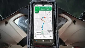
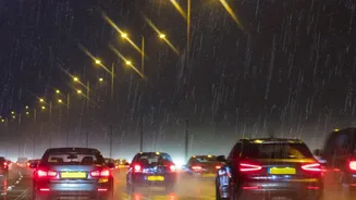
Road trips require extra caution during the monsoon. Slippery roads, poor visibility, and the risk of landslides in hilly areas are genuine concerns. Before you start, check the forecast not just for your destination, but for the entire route. Hilly regions in Himachal, Uttarakhand, and the Western Ghats are beautiful but can be risky, so avoid night driving in these areas. Always check with local sources—your hotel, taxi drivers, or state helpline numbers like the NHAI's 1033—for real-time road conditions. It is also wise to avoid blindly following GPS shortcuts, as smaller village roads may be flooded or washed away.
Navigating Flight and Train Travel
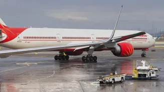
Monsoon rains significantly impact air and rail transport. Heavy downpours can cause waterlogging on runways, while lightning and turbulent storm clouds can lead to flight delays, diversions, or cancellations. Similarly, waterlogged tracks force trains to run at slower speeds, and landslides in ghat sections can shut down entire railway corridors for days, as recently seen on the busy Mumbai-Pune route. Airlines often issue travel advisories, so always check your flight or train status before leaving for the airport or station. Booking early morning flights can sometimes help you avoid afternoon storm-related disruptions.
Build a Flexible Itinerary
The single most important rule for monsoon travel is to remain flexible. Delays are common, so build buffer days into your itinerary, especially if you have connecting flights or trains. Avoid packing your schedule too tightly. A red alert at your destination might mean staying indoors for a day, so having a relaxed plan allows you to adapt without stress. Before your trip, call your hotel or homestay to ask about local conditions, including the state of access roads, power supply, and whether locals are travelling normally. This on-the-ground information is often the most valuable.